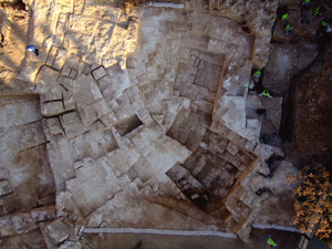
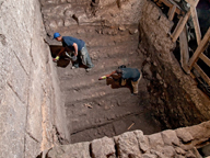
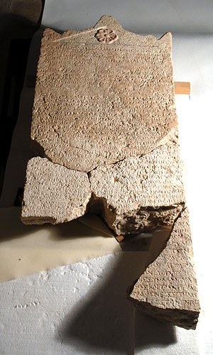
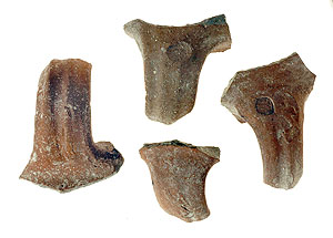
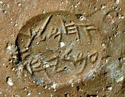
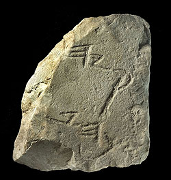
A fragment of a limestone plaque bearing several letters of ancient Hebrew script was discovered while sifting soil that was excavated in the vicinity of the Gihon Spring, within the precincts of the “Walls around Jerusalem National Park”.
The stone fragment dates to the eighth century BCE and this is based on the numerous pottery sherds that were discovered together with it, as well as the shape of the Hebrew letters that are engraved in the inscription.
The plaque is broken on all sides. All that remains of the inscription are two lines of writing: In the upper line the last part of a given name is preserved: ...]קיה, or as it is transliterated into English …]kiah. Unfortunately the remains of another letter before the kof cannot be discerned. If the letter preceding the kof was a zayin, we could complete the name to read חזקיה, or Hezekiah in English, and perhaps ascribe historical importance to the inscription. On the other hand, there are other first names that were used in Judah and Jerusalem at that time that could be mentioned here such as Hilkia, Amekiya, etc.
In the second line are the remains of two words. Here too, is a suffix of a word: ...]כה, or as it is transliterated into English …]ka. Here we have several possibilities for completing the word such as: בְּרָכָה, or birqa, that is, a greeting expressing best wishes (a possible ending for some sort of commemorative inscription). Another possibility is the word בְּרֵכָה, or brecha, meaning water reservoir. The reconstruction of this word is possible based on the fact that Brechat HaShiloah, or the Shiloah Pool in English, is located nearby, and also based on the fact that a pool is mentioned in the famous Shiloah inscription that was discovered close by.
In any event the fact that we are dealing with a stone plaque indicates that this is a commemorative inscription that may have been meant to celebrate some sort of building project.
All that remains is to wait and hope that in time other fragments of the inscription will be found.
Saturday, October 31, 2009
Wednesday, October 28, 2009
Quarry from the End of the Second Temple Period
.
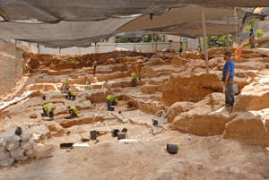
An ancient quarry, c. 1 dunam in area and dating to the end of the Second Temple period (c. 2,030 years old), was uncovered in excavations being conducted on Shmuel HaNavi Street in Jerusalem, under the direction of Dr. Ofer Sion and Yehuda Rapuano of the Israel Antiquities Authority, prior to the construction of residential buildings.
Dr. Ofer Sion, the excavation director on behalf of the Israel Antiquities Authority, believes, “The immense size of the stones (maximum dimensions: length 3 m, width 2 m, height 2 m) indicates it was highly likely that the large stones that were quarried at the site were destined for use in the construction of Herod’s magnificent projects in Jerusalem, including the Temple walls. It seems that a vast number of workers labored in the quarry where various size stones were produced: first they quarried small stones and when the bedrock surface was made level they hewed the large stones. The stones were quarried by creating wide detachment channels that were marked by means of a chisel which weighed c. 2.5 kilograms. After the channels were formed the stones were severed from the bedrock using hammers and chisels”.
“We know from historical sources that in order to build the Temple and other projects which Herod constructed, such as his palace, hundreds of thousands of various size stones were required – most of them weighing between two and five tons each”, said Dr. Sion. “The dimensions of the stones that were produced in the quarry that was revealed are suitable for the Temple walls. The large section that was exposed is actually a small part of an enormous series of quarries that was spread across the entire slope – from the Musrara Quarter to the Sanhedria Quarter. The massive quarrying effort, on the order of hundreds of thousands of stones, lowered the topography of Jerusalem in the vicinity of the Old City. Today, with the exposure of this quarry, the intensity of the building projects as described in the historical sources can be proven: Flavius Josephus wrote that before Herod built the Temple he prepared the infrastructure for it: the quarrying of the Temple’s stones lasted eight whole years. The Temple itself was built in a relatively short period of time of two years. With the exposure of the quarries in Sanhedria and Ramat Shlomo, it is clear that Herod began quarrying closest to the Temple and worked away from it: first he exploited the stone on the nearby ridges and subsequently he moved on to quarry in more distant regions”.
According to Dr. Sion, “In those days the world of hi-tech focused on quarrying, removing and transporting stones. Historical sources record that Herod trained more than 10,000 people to be involved in this work: they prepared suitable transportation routes and then moved the huge stones in a variety of ways – on rolling wooden fixtures that were drawn by camels, in pieces on carriages, etc.
Among the artifacts that were discovered in the excavation on Shmuel HaNaiv Street were metal plates (referred to in the Talmud as ‘cheeks’) that were used as fulcrums to severe the stones from the bedrock, and coins and pottery sherds that date to the end of the Second Temple period (the first century BCE).
2,000 Year Old Miqve in Jerusalem
-
A large and impressive ritual bath (miqve) from the end of the Second Temple period was recently uncovered in archaeological excavations the Israel Antiquities Authority is carrying out in the Western Wall tunnels, in cooperation with the Western Wall Heritage Foundation.
The miqve was discovered inside the western hall of a splendid structure that is located just c. 20 meters from the Western Wall. Parts of the building were discovered in the past and the Israel Antiquities Authority is currently exposing another one of the three halls inside it. It is one of the most magnificent structures from the Second Temple period ever to be uncovered.
The edifice is built of very delicately dressed ashlar stones and the architectural decoration in it is of the highest quality. From an architectural and artistic standpoint there are similarities between this structure and the three magnificent compounds that King Herod built on the Temple Mount, in the Cave of the Patriarchs and at Allonei Mamre, and from which we can conclude the great significance that this building had in the Second Temple period.
In his book The War of the Jews, Josephus Flavius writes there was a government administrative center that was situated at the foot of the Temple. Among the buildings he points out in this region were the council house and the “Xistus”- the ashlar bureau. According to the Talmud it was in this bureau that the Sanhedrin – the Jewish high court at the time of the Second Temple – would convene. It may be that the superb structure the Israel Antiquities Authority is presently uncovering belonged to one of these two buildings.
According to archaeologist Alexander Onn, director of the excavation on behalf of the Israel Antiquities Authority, “It is interesting to see that in the middle of the first century CE they began making changes in this magnificent structure – at that time it was no longer used as a government administrative building and a large miqve was installed inside its western hall where there were c. 11 steps that descend to the immersion pool. It seems that the city of Jerusalem grew in this period and it became necessary to provide for the increased ritual bathing needs of the pilgrims who came to the Temple in large numbers, especially during the three pilgrimage festivals (Shlosha Regalim). Immersing oneself in the miqve and maintaining ritual purity were an inseparable part of the Jewish way of life in this period, and miqve’ot were absolutely essential, especially in the region of the Temple.”
The Western Wall Heritage Foundation acts to uncover the Jewish people’s past at the Western Wall, and the miqve is further evidence of the deep ties the Jewish people have with Jerusalem and the Temple.
Rabbi Shmuel Rabinowitz, the rabbi in charge of the Western Wall and the holy places, pointed out the cooperation between the Western Wall Heritage Foundation and the Israel Antiquities Authority which have joined together in order to discover the rich history of Jerusalem there, while strictly ensuring that no excavations approach the Temple Mount compound, contact with which is forbidden by Halachic law.
Saturday, October 24, 2009
"The Heliodoros stele" and the Maccabean Revolt
"The Heliodoros stele"- consisting of 28 lines inscribed on limestone is considered one of the most important ancient inscriptions found in Israel. Recently, three smaller fragments of a Greek inscription were found at an Israel Antiquities Authority excavation at Maresha.
Dr. Dov Gera determined that the fragments were actually the lower portion of "The Heliodoros stele". This discovery confirmed the assumption that the stele originally stood in one of the temples in Maresha- Beit Guvrin National Park today. It now can be determined that this royal stele originated in the city of Maresha.
The stele adds important archaeological evidence and historical context for understanding the period of time leading up to the Maccabean Revolt, an event celebrated each year on the holiday of Hanukah.
The Heliodoros Stele - with all of its pieces restored - photograph Peter Lenny, Israel Museum Jerusalem
This royal stone stele bears a proclamation by the Seleucid king, Seleucus IV (brother of Antiochus IV), and dates to 178 BCE. The contents of the stele shed light on the Seleucid government's involvement in local temples, mentioning an individual named Olympiodoros, the appointed "overseer" of the temples in Coele Syria – Phoenicia, including Judea. The order of the king was sent to Heliodorus, who was probably the same person mentioned in II Maccabees 3.
According to the story in Maccabees, Heliodorus, as the representative of King Seleucus IV, tried to steal the wealth from the Temple in Jerusalem but instead was severely beaten as a result of divine intervention. Three years later Seleucus IV was assassinated and was succeeded by his brother Antiochus IV, who was the ruler who according to II Maccabees eventually issued an edict of persecution against the Jewish people and desecrated the Temple in Jerusalem leading to the Maccabean Revolt.
Royal seal impressions discovered
Royal seal impressions were discovered in excavations of the Israel Antiquities Authority at Umm Tuba, in the southern hills of Jerusalem.
Considering the limited area of the excavation and the rural nature of the structure that was revealed, the excavators were surprised to discover in it so many royal seal impressions that date to the reign of Hezekiah, King of Judah (end of the eighth century BCE). Four “LMLK” type impressions were discovered on handles of large jars that were used to store wine and oil in royal administrative centers. These were found together with the seal impressions of two high ranking officials named Ahimelekh ben Amadyahu and Yehokhil ben Shahar, who served in the kingdom’s government. The Yehokhil seal was stamped on one of the LMLK impressions before the jar was fired in a kiln and this is a very rare instance in which two such impressions appear together on a single handle.
Another Hebrew inscription, 600 years later than the seal impressions of the Kingdom of Judah, was discovered on a fragment of a jar neck that dates to the Hasmonean period. An alphabetic sequence was engraved with a thin iron stylus below the vessel’s rim in Hebrew script that is characteristic of the beginning of the Hasmonean period (end of the second century BCE). The letters hay to yod and a small part of the letter kaf were preserved on the sherd. Similar inscriptions bearing alphabetic sequences were discovered in the past, usually on ostraca (inscriptions written in ink on pottery sherds) or engraved on ossuaries (stone receptacles in which human bones were buried). The alphabetic inscription that was discovered in this instance is unique and the significance of it requires further study: was this a “writing exercise” done by an apprentice scribe or should we ascribe it some magical importance?
The remains of the large building included several rooms arranged around a courtyard. Pits, agricultural installations and subterranean silos were hewn inside the courtyard. A potter’s kiln, a large columbarium cave in which there is a rock-hewn hiding refuge, pottery vessels, etc were also discovered inside the built complex. The pottery vessels that were recovered from the ruins of the building indicate it first dates to the end of the Iron Age (the First Temple period) in the eighth century BCE. Following its destruction, along with Jerusalem and all of Judah during the Babylonian conquest, Jews reoccupied it in the Hasmonean period (second century BCE) and it existed for another two hundred years until the destruction of the Second Temple. During the Byzantine period the place was reinhabited as part of the extensive rural settlement of monasteries and farmsteads in the region between Jerusalem and Bethlehem.
Some three years ago the impressive remains of a monastery from this period were excavated that together with the remains of the current excavation confirm the identification of the place as “Metofa”, which is mentioned in the writings of the church fathers in the Byzantine period. The name of the Arab village, “Umm Tuba” is therefore a derivation of Byzantine “Metofa”, which is Biblical “Netofa” and is mentioned as the place from which two of David’s heroes originated (2 Samuel 23:28-29).
City of David: Magnificent Roman Building
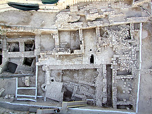
A spacious edifice from the Roman period (third century CE) – apparently a mansion that belonged to a wealthy individual – was recently exposed in the excavations the Israel Antiquities Authority is carrying out in the 'Givati Car Park' at the City of David, in the Walls Around Jerusalem National Park.
According to Dr. Doron Ben-Ami, the excavation director on behalf of the IAA, together with Yana Tchekhanovets, “Although we do not have the complete dimensions of the structure, we can cautiously estimate that the building covered an area of approximately 1,000 square meters. In the center of it was a large open courtyard surrounded by columns. Galleries were spread out between the rows of columns and the rooms that flanked the courtyard. The wings of the building rose to a height of two stories and were covered with tile roofs”.
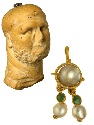
A large quantity of fresco fragments was discovered in the collapsed ruins from which the excavators deduced that some of the walls of the rooms were treated with plaster and decorated with colorful paintings. The painted designs that adorned the plastered walls consisted mostly of geometric and floral motifs. Its architectural richness, plan and particularly the artifacts that were discovered among its ruins bear witness to the unequivocal Roman character of the building. The most outstanding of these finds are a marble figurine in the image of a boxer and a gold earring inlaid with precious stones.
The building, which was constructed during the third century CE, was shaken by a tremor in the fourth century, the results of which are clearly apparently in the excavation area:the walls of the rooms caved-in and their stone collapse, which was piled high, covered the walls of the bottom floor, some of which still stand to a considerable height. Architectural elements such as columns and capitals, as well as mosaics and the large amount of fresco fragments that were used in the rooms of the second story were discovered inside the collapsed ruins. The coins that were discovered among the collapse and on the floors indicated the building’s ruins should be dated to circa 360 CE. It seems that what we have here is archaeological evidence of the results of the earthquake that struck our region in 363 CE.
Dr. Ben-Ami adds, “We know of no other buildings from the Roman period that were discovered in Israel which have a similar plan to that of the building from the City of David. The closest contemporary parallels to this structure are located in sites of the second-fourth century CE that were excavated in Syria. Edifices such as these are “urban mansions” from the Roman period that were discovered in Antioch, Apamea and Palmyra. If this parallel is correct, then in spite of its size and opulence, it seems that this building was used originally as a private residence”.
The exposure of the Roman building in the City of David is a significant contribution to our understanding of the extent of the construction in the Roman city in the third-fourth centuries CE. It constitutes extremely important archaeological evidence regarding the growth of the settlement at the end of the Roman period into the southern precincts of the city, and it shows that the prevailing supposition among scholars according to which the City of David hill remained outside the area of Roman settlement at the time of the Aelia Capitolina is no longer valid.
The Lod Mosaic And Its Builders
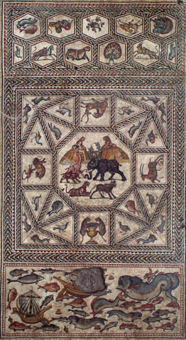
The 1,700 year old mosaic, which is one of the largest and most magnificent ever seen in Israel, was exposed in the city of Lod in 1996. It is a real archaeological gem that is extraordinarily well-preserved. It is c. 180 sq m in size. It is composed of colorful carpets that depict in great detail mammals, birds, fish, floral species, and sailing and merchant vessels that were in use at the time. It is believed the mosaic floor was part of a villa that belonged to a wealthy man in the Roman period.
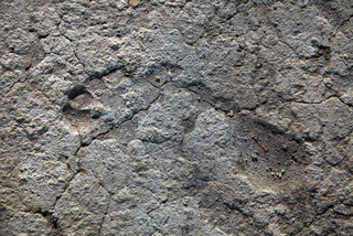
Recently the conservators were surprised to discover that the builders of the beautiful mosaic left their personal mark there: while working on the plaster bedding which is done before attaching the mosaic, the artisans trod on it wearing sandals and in their bare feet.
According to Jacques Neguer, head of the IAA Art Conservation Branch, “When removing a section of mosaic it is customary to clean its bedding, and that way study the material from which it is made and the construction stages. We look for drawings and sketches that the artists made in the plaster and marked where each of the tesserae will be placed. This is also what happened with the Lod mosaic: beneath a piece on which vine leaves are depicted, we discovered that the mosaic’s builders incised lines that indicate where the tesserae should be set, and afterwards, while cleaning the layer, we found the imprints of feet and sandals: sizes 34, 37, 42 and 44. At least one imprint of a sole resembles a modern sandal. Based on the concentration of foot and sandal prints it seems that the group of builders tamped the mortar in place with their feet”.
Neguer added, “The mosaic consists of three parts that different artists built, probably in different periods. There are different kinds of art here, and we can see that the hand that affixed the tesserae is different: a trained eye recognizes that the preparation which was done prior to the work is different. Besides the necessary professionalism, exposing the footprints is also the result of a lot of luck. It is not always possible to cut the layers of the mosaic precisely so that we discover such a clear picture of the plaster with the incising on it”.
Neguer states that, “the excitement here was great. It is fascinating to discover a 1,700 year old personal mark of people who are actually like us, who worked right here on the same mosaic. We feel the continuity of generations here”.
The hand and foot prints that were revealed will be removed from the area and will be conserved and returned to the site together with the mosaic, to the Shelby White and Leon Levy Lod Mosaic Archaeological Center.
The conservation of the site in Lod is meant to be a springboard that will boost tourism and a leverage that will alter the image of the city. The mosaic is located in the eastern part of Lod, next to the entrance at Ginnaton Junction. This intersection is easily reached from Ben Gurion Airport and from two of the country’s main highways: Highway 1, which connects Tel Aviv with Jerusalem, and Highway 6, which links the north of the country with the south. The site is situated between two streets: He-HalutzStreet, which leads to the marketplace and Struma Street, which leads to the city’s historic center. The location of the site next to the country’s main transportation arteries makes it highly accessible and will facilitate turning it into a site that is of interest to the entire country. The municipality, in cooperation with the Israel Antiquities Authority, plans to integrate it into a tourism circuit that will include a number of historic sites in the city.
Second Temple Period Stepped Street Discovered
A section of a stepped street paved in stone slabs, going south in the direction of the Shiloach Pool was discovered in excavations conducted by the Israel Antiquities Authority in the Shiloach Pool Excavation at the City of David in the Jerusalem Walls National Park. The excavations are conducted in cooperation with the Israel Nature and Parks Authority, funded by the Elad Foundation, under the auspices of Prof. Ronny Reich of Haifa University and Eli Shukron of the Israel Antiquities Authority.
The existence of this road has been known about for over one hundred years, since it was first discovered between 1894 and 1897 by Prof. Frederick J. Bliss and Archibald C. Dickey of the British Palestine Exploration Fund, and then covered and filled in at the end of their excavation. Other sections of this same road, to the north, have been excavated and covered over in the past, including during the excavations of Jones in 1937 and Kathleen Kenyon from 1961-1967.
This section of the stepped street was discovered at a distance of 550 meters south of the Temple Mount. The road represents the central thoroughfare of Jerusalem that ascended from the north-west corner of the Second Temple Shiloach Pool to the north.
According to Prof. Ronny Reich, "In the Second Temple Period, pilgrims would begin the ascent to the Temple from here. This is the southernmost tip of the road, of which a section has already been discovered along the western face of the Temple Mount."
The current excavation has been concentrated in a very narrow strip (1-2 meters in width) in the western sections of the road. Essentially, the excavation work removed the earth that had been filled in by previous excavators over the sections they already discovered. This section of road is built in the Second Temple style, which comprises alternating wide and narrow steps.
Further work must be done to clarify what the relationship was between the current excavated section and the section of the road and the drainage channel that were discovered nearby two years ago.
One of the Oldest Synagogues in the World
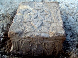
A synagogue from the Second Temple period (50 BCE-100 CE) was exposed in archaeological excavations the Israel Antiquities Authority is conducting at a site slated for the construction of a hotel on Migdal beach, in an area owned by the Ark New Gate Company. In the middle of the synagogue is a stone that is engraved with a seven-branched menorah (candelabrum), the likes of which have never been seen. The excavations were directed by archaeologists Dina Avshalom-Gorni and Arfan Najar of the Israel Antiquities Authority.
The main hall of synagogue is c. 120 square meters in area and its stone benches, which served as seats for the worshippers, were built up against the walls of the hall. Its floor was made of mosaic and its walls were treated with colored plaster (frescos). A square stone, the top and four sides of which are adorned with reliefs, was discovered in the hall. The stone is engraved with a seven-branched menorah set atop a pedestal with a triangular base, which is flanked on either side by an amphora (jars).
According to the excavation director, Dina Avshalom-Gorni of the Israel Antiquities Authority, “We are dealing with an exciting and unique find. This is the first time that a menorah decoration has been discovered from the days when the SecondTemple was still standing. This is the first menorah to be discovered in a Jewish context and that dates to the Second Temple period/beginning of the Early Roman period. We can assume that the engraving that appears on the stone, which the Israel Antiquities Authority uncovered, was done by an artist who saw the seven-branched menorah with his own eyes in the Temple in Jerusalem. The synagogue that was uncovered joins just six other synagogues in the world that are known to date to the SecondTemple period”.
According to the Minister of Culture and Sport, MK Limor Livnat, “This important find attests to the extensive Jewish settlement in the northern region at the time of the Temple. I am certain that the site will constitute an attraction for tourists from abroad and from Israel and will shed light on life in the Jewish settlement during the Second Temple period”.
Jose Miguel Abat, legal representative of "Ark New Gate" company, expressed his joy for the finding and said it reinforces the company's intention to establish a center of dialogue and respect between the different religions and cultures. Abat said that "we are sure this finding and the planned center will attract tourists and visitors from Israel and from around the World".
The synagogue is located in Migdal (‘Magdala’ in Aramaic), which is mentioned in Jewish sources. Migdal played an important role during the Great Revolt and was actually the main base of Yosef Ben Matityahu (Josephus Flavius), commander of the rebellion in the Galilee. Migdal also continued to resist the Romans after both the Galilee and Tiberias had surrendered. ‘Magdala’ is mentioned in Christian sources as the place whence Mary Magdalene came, one of the women who accompanied Jesus and the apostles and who Christian tradition has sanctified. After it was conquered by the Romans, the city was destroyed and many of its residents were killed. At the end of the Second Temple period Migdal was an administrative center of the western basin of the Sea of Galilee. Until the founding of Tiberias in the year 19 CE, Migdal was the only important settlement along the shore of the Sea of Galilee.
3,700 Year Old Fortification in the City of David
An Enormous 3,700 Year Old Fortification was Exposed in the City of David
A huge fortification more than 3,700 years old, which is ascribed to the Canaanites (Middle Bronze Age 2), was uncovered in archaeological excavations the Israel Antiquities Authority is currently conducting in the “Walls Around Jerusalem" ational Park in the City of David, with funding provided by the ‘Ir David' Foundation.
According to the director of the excavation, Professor Ronny Reich of the University of Haifa, together with Eli Shukron on behalf of the Israel Antiquities Authority, “This is the most massive wall that has ever been uncovered in the City of David, and it rises to a height of 8 meters. We are dealing with a gigantic fortification, from the standpoint of the structure’s dimensions, the thickness of its walls and the size of the stones that were incorporated in its construction. The walls appear to be a protected, well-fortified passage that descends to the spring tower from some sort of fortress that stood at the top of the hill.
The construction of a protected passage such as this is a plausible solution that explains the innate contradiction of the situation whereby the spring – which is a source of life from the standpoint of the fortress’ inhabitants in time of emergency – is located in the weakest and most vulnerable place in the area. The construction of a protected passage, even though it involves tremendous effort, is a solution for which there are several parallels in antiquity, albeit from periods that are later than the remains described here.
A small section of the fortification was discovered in 1909, and it has been ascertained in the present excavations that it was part of an enormous wall. This is the first time that such massive construction that predates the Herodian period has been discovered in Jerusalem”.
During this period Jerusalem and the fields around it were an independent political entity with self-rule, similar to its neighbors Shechem to the north and Jericho to the east. Massive walls resembling the one that was just exposed in Jerusalem are known from Canaanite Hebron (Tel Rumeida), Shechem (Tell Balata) and Gezer.
According to Professor Reich, “Even though it would seem we are dealing with impressive fortifications, the walls were after all primarily used to defend against marauding desert nomads who wanted to rob the city. These are the earliest fortifications in the region and they bear witness to the fact that from this point on the settlement had became an urban entity with a ruler who had the capability and resources to build such a structure. A small settlement would have been unsuccessful in organizing such construction”.
The known section of the fortification is 24 meters long; however, it is thought the fortification is much longer because it continues west beyond the part that was exposed, at the top of the hillside. Professor Reich adds, “The new discovery shows that the picture regarding Jerusalem’s eastern defenses and the ancient water system in the Middle Bronze Age 2 is still far from clear. Despite the fact that so many have excavated on this hill, there is a very good chance that extremely large and well-preserved architectural elements are still hidden in it and waiting to be uncovered”.
Omrit - Herod's mystery temple?
Specials
Eldan Rent a Car
Israel's leading car rental company offers a 20% discount on online reservations
Israeli Basketball
Watch Live Israeli Premier Basketball Games
Desert lodging & activity
Tents, camping & cabins, various activities and meals in the Negev
The Best Jewish Charity
Learn how Efrat saved 30,000 lives of Jewish children
Tamir Rent a car
Car rental in Israel, special prices
Tour guides in Israel
Choose you’re your tour guide in Israel
Kosher cruises
Attractions In Israel
Hotels In Israel
Jerusalem hotels
Tel Aviv hotels
Eilat hotels
Israel guide
Your guide to Israel
Download JPost.com's toolbar and listen to Israeli radio 24/7
Green Israel
Protecting Israel's environment
Unique gifts from Israel
Careers at JPost
online news world wide
Middle East & Israel Breaking News » Local Israel » Around Israel » Article
Sep 19, 2009 3:04 | Updated Sep 21, 2009 17:07
Omrit - Herod's mystery temple?
By STEPHEN G. ROSENBERG
Print Subscribe
E-mail Toolbar
+ Recommend:
What's this?
On a good day, you can see it from a distance. It stands proudly on a ridge below a higher peak at a site where you would least expect to see a fine Roman structure. Although it lies in ruins, the white structure stands out in a landscape of black basalt rocks, typical of the Golan. Before 1967, it was the site of a Syrian military bunker.
Khirbet Omrit (the Arabic name) rests on the border between the Galilee and the Golan, on what was the boundary between civilization and barbarity. At first, during the Roman occupation of Palestine, the Galilee was also a wild and unruly area where the young Herod was sent to restore order. He did this with his usual ruthless brutality, not allowing humanity to stand in the way of good order. As a result of his success, his masters in Rome saw he was suited to become King of Judea. Later this cruelly successful mode of operation also gained him rule over the Golan, which was added to his kingdom in about 30 BCE.
Herod remembered this border territory, the site of his early triumph, and came back one day to build a temple to his patron, the Emperor Augustus. According to the first-century historian Josephus Flavius, after Caesar granted Herod the territory of the local governor who had died, "he [Herod] erected for him [Augustus] a beautiful temple in white stone in the territory of Zenodorus, near the place called Paneion [today, Banias]" (Antiquities 15: 363).
This white stone building at Omrit stands in the middle of nowhere today, but this was not so in antiquity. Recent excavations have shown that it stood alongside the Roman road from Tyre to Damascus, where it was joined by the route from Scythopolis (Beit-She'an) to Damascus. The temple stood high above the road and was joined to it by an avenue of columns that led to a bridge across the wadi Al-Hazin, which the road followed.
A colonnaded way means a road of shops, and that means commercial activity - here associated with travelers as well as locals. Omrit was a way-station on the road to Damascus, the seat of the senior Roman procurator who supervised Syria, which included Palestine.
Herod built three temples in honor of his patron Augustus. One stood at Sebastia (Samaria) and a second one at Caesarea. Where was the third? Some archeologists think it was at Banias itself, but that city was dedicated to the god Pan.
Andrew Overman of Macalester College in the US thinks the temple was at Omrit. Overman has been digging at the site for nearly 10 years and sees in the remains all the unique characteristics and high quality of Herod's methods of building. Like the other two temples, Omrit was approached by a grand flight of stairs that led to a portico of six columns and onto the cella, or enclosed shrine, which would have housed a statue of Augustus, as the Romans considered him a god. It is perhaps significant that the temple faced west, toward Rome and the emperor, and in front of the temple there was a paved area with an altar that would have been used for libations in his honor.
The high quality of the stonework, laid in headers and stretchers without mortar, and the finely carved capitals all point to the work of Herod the Great. So does the concept itself, of an isolated temple standing impressively on a high podium on a prominent ridge to make it visible and even overpowering from afar.
The excavators found that there was a second stage of the construction, which surrounded the original structure with a colonnade of eight columns on each side and six at the rear, which would have made the temple even more impressive. The original columns were of the Ionic order, consisting of spiral ends, while the new colonnade was of the Corinthian order, carved with elaborate acanthus leaves, all in fine Roman style, based on Greek originals.
This expanded temple is dated to about 100 years later than the original and may have been ordered by Herod's grandson Agrippa II, who ruled the area of Gaulanitis (Golan) from 54 CE to 66 CE. It shows the continued importance of the location well after the time of Herod, and even after the Jewish Revolt of 66 CE, which destroyed much of Jewish life in the Galilee. It may well reflect the importance of the Golan to the Galilee refugees of the revolt.
All the work of the temple is in shining white limestone, which would have had to be imported into this area of black basalt rocks. The local primitive buildings of the time are all in the local basalt, but although that was easily available, it was hard and difficult to work. Herod and his grandson used limestone to good effect. It was unusual for the area, it gleamed white in the sunlight and it shone from afar. It was also much easier to carve than basalt, and the stonemasons had to carve six Ionic capitals and then 20 Corinthian ones, all in intricate detail.
The carved stonework was not the only decoration. Internally the early cella was painted with frescoes. The later work revealed inscribed fragments, one with the Greek letters "Aphro," standing for the goddess Aphrodite, and marble reliefs of a priest with a cornucopia, of a slain deer attacked by another beast, and of a sphinx.
The temple probably stood for many years while the character of the site slowly changed to commercial and industrial use, and the temple site and stonework may have been used to create a chapel, where two crosses in black basalt were found.
The late Roman remains show an active village site, perhaps an early Judeo-Christian community, thriving alongside an active trade route to Damascus and the coast.
The temple-shrine may have come to an end after the severe earthquake of 363, but life continued in the Byzantine period until the massive quake of 749, which destroyed so many of the buildings in the Golan. The site was then abandoned, but a few late remains of the 13th century were found, with crude houses and cooking equipment - perhaps a camp of semi-nomads and their animals seeking refuge from the more regulated areas of the Galilee. By then, however, the Roman roads had been abandoned, and the area returned to its original wild state, which it retains today.
Friday, October 23, 2009
‘Lucy’ Species Ate a Different Diet
than Previously Thought
Research examining microscopic marks on the teeth of the “Lucy” species Australopithecus afarensis suggests that the ancient hominid ate a different diet than the tooth enamel, size and shape suggest, say a University of Arkansas researcher and his colleagues.
“The Lucy species is among the first hominids to show thickened enamel and flattened teeth,” an indication that hard, or abrasive foods such as nuts, seeds and tubers, might be on the menu, Ungar said. However, the microwear texture analysis indicates that tough objects, such as grass and leaves, dominated Lucy’s diet.
“This challenges long-held assumptions and leads us to questions that must be addressed using other techniques,” Ungar said. Researchers thought that with the development of thick enamel, robust skulls and large chewing muscles, these species had evolved to eat hard, brittle foods. However, the microwear texture analysis shows that these individuals were not eating such foods toward the end of their lives.
The researchers used a combination of a scanning confocal microscope, and scale-sensitive fractal analysis to create a microwear texture analysis of the molars from 19 specimens of A. afarensis, the Lucy species, which lived between 3.9 and 2.9 million years ago, and three specimens from A. anamensis, which lived between 4.1 and 3.9 million years ago. They looked at complexity and directionality of wear textures in the teeth they examined. Since food interacts with teeth, it leaves behind telltale signs that can be measured. Hard, brittle foods like nuts and seeds tend to lead to more complex tooth profiles, while tough foods like leaves generally lead to more parallel scratches, which corresponds with directionality.
“The long-held assumption was that with the development of thick enamel, robust skulls and larger chewing muscles marked the beginning of a shift towards hard, brittle foods, such as nuts, seeds and tubers,” Ungar said. “The Lucy species and the species that came before it did not show the predicted trajectory.”
Next they compared the microwear profiles of these two species with microwear profiles from Paranthropus boisei, known as Nutcracker Man that lived between 2.3 and 1.2 million years ago, P. robustus, which lived between 2 million and 1.5 million years ago, and Australopithecus africanus, which lived between about 3 million and 2.3 million years ago. They also compared the microwear profiles of the ancient hominids to those of modern-day primates that eat different types of diets.
The researchers discovered that microwear profiles of the three east African species, A. afarensis, A. anamensis and P. boisei, differed substantially from the two south African species, P. robustus and A. africanus, both of which showed evidence of diets consisting of hard and brittle food.
“There are huge differences in size of skull and shape of teeth between the species in eastern Africa, but not in their microwear,” Ungar said. “This opens a whole new set of questions.”
Monday, October 19, 2009
The historical importance of Jerusalem's geology
Jerusalem's geology has been crucial in molding it into one of the most religiously important cities on the planet, according to a new study.
It started in the year 1000 BCE, when the Jebusite city's water system proved to be its undoing. The Spring of Gihon sat just outside the city walls, a vital resource in the otherwise parched region. But King David, intent on taking the city, sent an elite group of his soldiers into a karst limestone tunnel that fed the spring. His men climbed up through a cave system hollowed out by flowing water, infiltrated beneath the city walls, and attacked from the inside. David made the city the capital of his new kingdom, and Israel was born.
In a new analysis of historical documents and detailed geological maps, Michael Bramnik of Northern Illinois University will add new geological accents to this pivotal moment in human history in a presentation Tuesday, October 20 at the annual meeting of the Geological Society of America in Portland.
"The karst geology played a major role in the city's selection by David for his capital," Bramnik said.
It proved to be a wise decision. One of David's successors, King Hezekiah watched as the warlike Assyrian horde, a group of vastly superior warriors toppled city after city in the region. Fearing that they'd soon come for Jerusalem, he too took advantage of the limestone bedrock and dug a 550 meter-long (1804 feet) tunnel that rerouted the spring's water inside the city's fortified walls.
The Assyrians laid siege to the city in 701 BCE, but failed to conquer it. It was the only city in history to successfully fend them off.
"Surviving the Assyrian siege put it into the people's minds that it was because of their faith that they survived," Bramnik said. "So when they were captured by the Babylonians in 587, they felt it was because their faith had faltered."
Until then, the Jewish religion had been loosely associated. But that conviction united the Jews through the Babylonian Captivity, "and so began modern congregational religion," Bramnik said.
In an arid region rife with conflict, water security is as important today as it was during biblical times. While the groundwater for Jerusalem is recharged surface waters in central Israel, other settlements' water sources are not publicly available for research. Bramnik's efforts to find detailed hydrological maps were often rebuffed, or the maps were said to be non-existent.
"I think Jerusalem's geology and the geology of Israel is still significant to life in the region, perhaps even reaching into the political arena," he said.
Thursday, October 15, 2009
700 Aramaic Documents From 500 B.C.
New technologies and academic collaborations are helping scholars at the University of Chicago analyze hundreds of ancient documents in Aramaic, one of the Middle East’s oldest continuously spoken and written languages.
Members of the West Semitic Research Project at the University of Southern California are helping the University’s Oriental Institute make very high-quality electronic images of nearly 700 Aramaic administrative documents. The Aramaic texts were incised in the surfaces of clay tablets with styluses or inked on the tablets with brushes or pens. Some tablets have both incised and inked texts.
Discovered in Iran, these tablets form one of the largest groups of ancient Aramaic records ever found. They are part of the Persepolis Fortification Archive, an immense group of administrative documents written and compiled about 500 B.C. at Persepolis, one of the capitals of the Achaemenid Persian Empire. Archaeologists from the Oriental Institute discovered the archive in 1933, and the Iranian government has loaned it to the Oriental Institute since 1936 for preservation, study, analysis and publication.
The Persepolis texts have started to provide scholars with new knowledge about Imperial Aramaic, the dialect used for international communication and record-keeping in many parts of the Assyrian, Babylonian and Persian empires, including parts of the administration at the imperial court of Persepolis. These texts have even greater value because they are so closely connected with documents written in other ancient languages by the same administration at Persepolis.
“We don’t have many archives of this size. A lot of what’s in these texts is entirely fresh, but this also changes what we already knew,” said Annalisa Azzoni, an assistant professor at the Divinity School of Vanderbilt University. Azzoni is a specialist on ancient Aramaic and is now working with the Persepolis Fortification Archive Project at the Oriental Institute. “There are words I know were used in later dialects, for example, but I didn’t know they were used at this time or this place, Persia in 500 B.C. For an Aramaicist, this is quite an important discovery.”
Clearer images delivered more quickly
Scholars from the West Semitic Research Project at the University of Southern California helped the Persepolis Fortification Archive Project build and install an advanced electronic imaging laboratory at the Oriental Institute. Together, the two projects are making high-quality images of the Aramaic texts and the seal impressions associated with those texts. They are distributing the new images to the international research community through the Internet.
Inked and incised texts pose different problems that call for different imaging solutions. Making high-resolution scans under polarized and filtered light reveals the ink without interference from stains and glare, and sometimes shows faded characters that cannot be seen in ordinary daylight. Using another advanced imaging technique, called Polynomial Texture Mapping, researchers are able to see surface variations under variable lighting, revealing the marks of styluses and even the traces of pens in places where the ink itself has disappeared.
Distributing the results online will give worldwide communities of philologists and epigraphers images that are almost as good as the original objects―and in some cases actually clearer than the originals―to study everything from vocabulary and grammar to the handwriting habits of individual ancient scribes.
Researcher Marilyn Lundberg and her colleagues from the West Semitic Research Project built two Polynomial Texture Mapping devices from scratch at the Oriental Institute. They trained Persepolis Fortification Archive Project workers in using them, and also in using filtered light with a camera equipped with a high-resolution scanning device. Now a stream of raw images is uploaded every day to a dedicated server maintained by Humanities Research Computing at Chicago, then uploaded for post-processing at the University of Southern California. Fully processed imagery is available on InscriptiFact, the online application of the West Semitic Research Project, and in the Online Cultural Heritage Research Environment, the online application of the Persepolis Fortification Archive Project.
Seeing the whole picture
The Polynomial Texture Mapping apparatus looks a bit like a small astronomical observatory, with a cylindrical based topped by a hemispherical dome. The camera takes a set of 32 pictures of each side of the tablet, with each shot lit with a different combination of 32 lights set in the dome. After post-processing, the PTM software application knits these images to allow a viewer sitting at a computer to manipulate the apparent direction, angle and intensity of the light on the object, and to introduce various effects to help with visualization of the surface.
“This means that the scholar isn’t completely dependent on the photographer for what he sees anymore,” said Bruce Zuckerman, Director of the West Semitic Research Project and its online presence, InscriptiFact. “The scholar can pull up an image on the screen and relight an object exactly as he wants to see it. He can look at different parts of the image with different lighting, to cast light and shadow across even the faintest, shallowest marks of a stylus or pen on the surface, and across every detail of a seal impression.”
“This is a wonderful way to look at seal impressions,” said Elspeth Dusinberre, another Persepolis Fortification Project collaborator. Dusinberre, an associate professor of classics at the University of Colorado, is studying the imagery and the use of seals impressed on the Aramaic tablets. “Some of the impressions are faint, or incomplete, on curved surfaces or damaged surfaces. Sometimes Aramaic text is written across them. You need to be able to move the light around to highlight every detail, to see the whole picture.”
The Persepolis Fortification Archive also includes about 10,000 to 12,000 other tablets and fragments with cuneiform texts in Elamite―a few hundred of them with short secondary texts in Aramaic. There are also about 4,000 to 5,000 others with impressions of seals, but no texts, and there are a few unique documents in other languages and scripts, including Greek, Old Persian and Phrygian.
“That’s what makes this group of Aramaic texts so extraordinary,” Stolper said. “From one segment of the Persepolis Fortification Archive, the Elamite texts, we know a lot about conditions around Persepolis at about 500 B.C. When we can add a second stream of information, the Aramaic texts, we’ll be able to see things in a whole new light. They add a new dimension of the ancient reality.”
Impacts are far-reaching
The collaboration between the Oriental Institute at Chicago and the West Semitic Research Project at Southern California began with support from a substantial grant from the Andrew W. Mellon Foundation in 2007. To date, the teams have made high-quality images of almost all the monolingual Aramaic Fortification tablets. The next phase of the work, supported by a second Mellon grant that runs through 2010, will make images of the short Aramaic notes written on cuneiform tablets, seal impressions on uninscribed tablets and previously unrecorded Elamite cuneiform texts.
The tablets have been studied since they came to Chicago in 1936, and many of them have been sent back to Iran. Oriental Institute scholar Richard T. Hallock published about 2,100 of the Elamite texts in 1969, and Margaret Cool Root and Persepolis Fortification Archive Project collaborator Mark Garrison are completing a three-volume publication of the impressions made on those documents by about 1,500 distinct seals.
These publications have had far-reaching results. “They have transformed every aspect of modern study of the languages, history, society, institutions, art and religion of the Achaemenid Persian Empire,” Stolper said. “No serious treatment of the empire that Cyrus and Darius built and that Alexander destroyed can ignore the perspectives of the Fortification Archive.”
“If that is the effect of a sample of one component of the archive,” added Garrison, “imagine what will happen when we can have larger samples and other components, and not just the written record, but the imagery, the impressions made by thousands of different seals that administrators and travelers―the men and women who figure in the texts―employed.”
By 2010, the collaborating teams expect to have high-quality images of 5,000 to 6,000 Persepolis tablets and fragments, and to supplement these with conventional digital images of another 7,000 to 8,000 tablets and fragments. The images will be distributed online as they are processed, along with cataloging and editorial information.
“Thanks to electronic media, we don’t have to cut the parts of the archive up and distribute the pieces among academic specialties,” said Stolper. “We can combine the work of specialists in a way that lets us see the archive as it really was, in its original complexity, as one big thing with many distinct parts.”
Thursday, October 8, 2009
Studying Pompeii's Graffiti
Uncovering the Graffiti of Pompeii
Released: 10/8/2009 3:00 PM EDT
Today, a kid spray painting a wall with graffiti would probably get arrested.
But 1,900 years ago in Pompeii, Italy, everybody was doing it. They wrote on the exteriors of houses up and down the street, in bath houses and in kitchens. Everything was fair game.
Rebecca Benefiel, assistant professor of classics at Washington and Lee University, has spent the last three years studying the more than 11,000 graffiti in Pompeii. "It's the only site where we have an entire city's worth of these messages," she said.
The graffiti present a combination of writing and drawings, with writing being the more common form of expression. Benefiel said she sees the graffiti as the voice of the people and a lens through which to view ancient society.
For example, while history has not treated the Emperor Nero kindly, he was in fact very popular with the locals in Pompeii. Benefiel came across numerous graffiti saying "Neroni Feliciter," which roughly translates into "Long Live Nero."
Of the 100 graffiti praising the different emperors, Benefiel estimates more than half were for Nero. "He was incredibly popular and people loved him. I found a lot of the graffiti at the entrances to houses of the wealthy (who would have had a stake in declaring their support of the imperial regime). But I also found them in places like kitchens and hallways where they could have been put up by servants of the house or slaves. However, after Nero kicked his pregnant wife, killing her and the baby, his popularity waned. But even so, the people didn't go back and erase all their previous declarations of love."
It's the sort of discovery that fascinated and enchanted Benefiel about ancient graffiti.
Interest in the subject has also been surging among other academics. In the past three years, four conferences have been devoted to the topic. By fall 2009, Benefiel will have spoken at three of them.
You would think that graffiti nearly 2,000 years old would have been studied extensively by now and that there would be little left to write about.
The reality is that Benefiel is one of few scholars to really study this ancient graffiti of Pompeii. "The graffiti were basically ignored because as one scholar put it, "The graffiti are not written by the kind of people we are most interested in meeting,'" explained Benefiel.
She first came across them in 2005 while researching her dissertation. "They were fundamentally interesting, and I realized that the majority of them had never been studied," she said.
A major international project begun in the late 1800s documented and cataloged all the Latin inscriptions from the ancient world in every country. Benefiel had worked earlier with stone inscriptions from Rome, but since coming to W&L has focused her studies on the wall-inscription from Pompeii. "They contain a wealth of details about popular culture of the Roman Empire," she said.
Benefiel added that it was fortunate that the graffiti had been recorded, because many of them have now vanished as the wall plaster they were written on has crumbled.
Two-thirds of Pompeii has been uncovered and is now deteriorating from exposure to strong sunlight, rain, creeping vegetation and tourists. Benefiel said that the authorities have been putting a great effort into preserving the city in the last few years. "But you're probably not going to see any brand-new excavations any time soon, for that reason," she said.
Pompeii is unique in its preservation of life as it was in 79 A.D., when Mount Vesuvius erupted. It buried the city with a light pumice stone called lapilli that gradually covered the houses to about the second story during a period of 36 hours. "You can easily shovel the lapilli into a bucket," said Benefiel. "In a matter of days you've got a whole building cleared."
This means the first stories of buildings are very well preserved, and that is where Benefiel carries out some of her research.
"I really do love Pompeii," she said. "You can walk through the spaces and feel that people lived here. You can go into someone's garden or latrine and you know this space because it's familiar. You're standing in someone's house. It's wonderful for that sense of immediacy."
These ancient houses all faced inward with an internal court containing a pool and gardens. That left a blank façade facing the street, explained Benefiel, and plenty of space for writing graffiti on what was seen as a public space. In fact all façades of buildings could be written on in every street.
"These walls were huge message boards," said Benefiel. "What's really fun is how interactive the graffiti was. It's fascinating because it shows how engaged the people were in the writing process. They were reading the messages around them and writing responses."
Benefiel found messages of love exchanged between a man (named Secundus or "Second") and a woman (named Prima, or "First") who lived at different ends of a city block.
She discovered a poetry competition with eight messages. "Someone starts off quoting a verse of poetry, and then someone else adds to it and so forth. It's very interactive and you can see that there are different styles of handwriting."
Benefiel explained that the graffiti is incised into the wall plaster and all anyone would need was a sharp implement. "It was pretty easy to carve the stucco," she said.
Ardi Walked In The Woods
Among the many surprises associated with the discovery of the oldest known, nearly complete skeleton of a hominid is the finding that this species took its first steps toward bipedalism not on the open, grassy savanna, as generations of scientists – going back to Charles Darwin – hypothesized, but in a wooded landscape.
Ambrose analyzed the teeth of two-dozen mammal species found in the same ancient soil layer as Ardipithecus in order to help reconstruct its environment. A modern hippopotamus tooth is pictured. |
“This species was not a savanna species like Darwin proposed,” said University of Illinois anthropology professor Stanley Ambrose, a co-author of two of 11 studies published this week in Science on the hominid, Ardipithecus ramidus. This creature, believed to be an early ancestor of the human lineage, lived in Ethiopia some 4.4 million years ago.
One of the crucial pieces of evidence to show that Darwin didn’t get it right, Ambrose said, was the analysis of carbon isotopes in the soil and in the teeth of Ardipithecus and other animals that lived at roughly the same time and in the same location.
The mass of carbon atoms in the atmosphere varies, and during photosynthesis, trees and tropical grasses absorb different proportions of carbon-12, the most common carbon isotope, and carbon-13, which is rare. These isotopes pass into the soil and into the bodies of animals that eat the plants, making it possible to accurately reconstruct the proportions of grass to trees on the landscape and in the diets of the animals that lived there.
Ambrose analyzed stable carbon isotope ratios in the soil in which the bones of 36 Ardipithecus individuals were found. He also analyzed the teeth of five Ardipithecus individuals and 172 teeth of two-dozen mammal species found in the same ancient soil layer.
The fossil-bearing layer, in the Afar Rift region of northeastern Ethiopia, spans a broad arc about 9 kilometers long. Sandwiched between two layers of volcanic ash that both date to about the same age, it provides a well-focused snapshot of an ancient African ecosystem.
The carbon isotope ratios of the soils indicated that in the time of Ardipithecus the landscape varied from woodland in the western part of the study zone to wooded grassland in the east. None of the Ardipithecus specimens were found in the grassy eastern part of the arc.
“Fossils of many species are common all the way across the landscape,” Ambrose said. “But this species is missing in action from the east side of the distribution.”
Isotopic analysis of teeth found on the site gave a more complete picture of the habitat of the animals that lived and died there, Ambrose said.
“The distribution of plant carbon isotope ratios conveniently separates out grasslands from forests,” he said. “And it also separates out grazing animals, like zebras, from browsing animals that eat the leaves off of trees, like giraffes.”
The distribution of the fossil browsers and grazers echoed that of the habitat, he said.
“On the west we find lots of Ardipithecus fossils and they’re associated with a lot of woodland and forest animals,” he said. “And then there’s a break; Ardipithecus and most of the monkeys that live in trees disappear, and grass-eating animals become more abundant.”
The carbon isotope ratios of the Ardipithecus teeth also tell the story of a woodland creature, he said.
“The diet of the Ardipithecus is much more on the woodland and forest side,” he said. “It’s got a little bit more of the grassland ecosystem carbon in its diet than that of a chimpanzee but much less than its fully bipedal savanna-dwelling descendents, the australopithecines.”
This evidence, along with the anatomical studies indicating that Ardipithecus could walk upright but also grasped tree limbs with its feet, suggests that this early hominid took its first steps on two legs in the forest long before it ventured very far into the open grassland, Ambrose said.
“Multiple lines of evidence now suggest that they were beginning to leave the trees before they left the forest,” he said.
Friday, October 2, 2009
Ardi displaces Lucy as oldest hominid skeleton
Ethiopian desert yields fossils that paint new picture of human evolution
Nearly 17 years after plucking the fossilized tooth of a new human ancestor from a pebbly desert in Ethiopia, an international team of scientists today (Thursday, Oct. 1) announced their reconstruction of a partial skeleton of the hominid, Ardipithecus ramidus, which they say revolutionizes our understanding of the earliest phase of human evolution.
The female skeleton, nicknamed Ardi, is 4.4 million years old, 1.2 million years older than the skeleton of Lucy, or Australopithecus afarensis, the most famous and, until now, the earliest hominid skeleton ever found. Hominids are all fossil species closer to modern humans than to chimps and bonobos, which are our closest living relatives.
"This is the oldest hominid skeleton on Earth," said Tim White, University of California, Berkeley, professor of integrative biology and one of the co-directors of the Middle Awash Project, a team of 70 scientists that reconstructed the skeleton and other fossils found with it. "This is the most detailed snapshot we have of one of the earliest hominids and of what Africa was like 4.4 million years ago."
White and the team will publish the results of their analysis in 11 papers in the Oct. 2 issue of the journal Science, which has Ardi on the cover. They announced their findings at press conferences held simultaneously today in Washington, D.C., and Addis Ababa, Ethiopia.
The team's reconstruction of the 4-foot-tall skeleton and of Ardi's environment – a woodland replete with parrots, monkeys, bears, rhinos, elephants and antelope – alters the picture scientists have had of the first hominid to arise after the hominid line that would eventually lead to humans split about 6 million years ago from the line that led to living chimpanzees.
Based on a thorough analysis of the creature's foot, leg and pelvis bones, for example, the scientists concluded that Ardi was bipedal – she walked on two legs – despite being flat-footed and likely unable to walk or run for long distances.
In part, this primitive ability to walk upright is because Ardi was still a tree-dweller, they said. She had an opposable big toe, like chimpanzees, but was probably not as agile in the trees as a chimp. Unlike chimps, however, she could have carried things while walking upright on the ground, and would have been able to manipulate objects better than a chimp. And, contrary to what many scientists have thought, Ardi did not walk on her knuckles, White said.
"Ardi was not a chimpanzee, but she wasn't human," stressed White, who directs UC Berkeley's Human Evolution Research Center. "When climbing on all fours, she did not walk on her knuckles, like a chimp or gorilla, but on her palms. No ape today walks on its palms."
Ardi's successor, Lucy, was much better adapted for walking on the ground, suggesting that "hominids became fundamentally terrestrial only at the Australopithecus stage of evolution," he said.
Based on Ardi's small, blunt, upper canine teeth, the team also argues that the males of that species did not engage in the same fearsome, teeth-baring threat behavior common in chimpanzees, gorillas and orangutans. Instead, they must have had a more amicable relationship, the scientists said, implying that several pair-bonded couples lived together in social units. Males may even have helped in gathering food for sharing.
"The novel anatomy that we describe in these papers fundamentally alters our understanding of human origins and early evolution," said anatomist and evolutionary biologist C. Owen Lovejoy of Kent State University, a scientist with the project. In a summary article in Science, Lovejoy wrote that these and other behaviors "would have substantially intensified male parental investment – a breakthrough adaptation with anatomical, behavioral, and physiological consequences for early hominids and for all of their descendants, including ourselves."
Until now, the oldest fossil skeleton of a human ancestor was the 3.2-million-year-old partial skeleton of Lucy, discovered in the Afar depression of Ethiopia, near Hadar, in 1974 and named Au. afarensis.
In 1992, however, while surveying a site elsewhere in the Afar, near the village of Aramis, 140 miles northeast of Addis Ababa, Middle Awash Project scientist Gen Suwa discovered a tooth from a more primitive creature more than 1 million years older than Lucy. After more fossils of the creature were found in the area from some 17 individuals, Suwa, White and project co-leader Berhane Asfaw published the discovery in the journal Nature in 1994.
Although that first paper initially conservatively placed the chimp-like creature in the Australopithecus genus with Lucy, the team subsequently created a new genus – Ardipithecus – for the hominid because of the fossils' significantly more primitive features.
After preparing their first report, the scientists continued to find more Ar. ramidus fossils in the Aramis area. A hand-bone discovered in 1994 by project scientist Yohannes Haile-Selassie, a paleontologist and curator at the Cleveland Museum of Natural History, eventually led the team to the partial skeleton now known as Ardi, which they excavated during three subsequent field seasons. The skeleton was disarticulated and scattered, and broken into smaller pieces: 125 fragments of skulls, teeth, arms, hands, the pelvis, legs and feet. In addition to this skeleton, the area yielded a total of 110 other catalogued specimens representing body parts of at least 36 other Ardipithecus individuals.
After the bones were excavated at the site, they were molded and painstakingly removed from their protective plaster jackets in the laboratory in Addis Ababa, where they were then photographed and reconstructed. Micro-CT scanners were used to study the inner and outer anatomy of the bones and teeth, and scanning electron microscopes were used to study the structure and surface details. The 5,000 micro-CT slices through the broken skull allowed the team to reconstruct it on a computer and then "print" it on a 3-D stereolithic printer at the University of Tokyo. A cast of Ardi's skull, along with video and comparisons, can be seen now in the Human Evolution display on the second floor of UC Berkeley's Valley Life Sciences Building.
In all, 47 scientists from 10 countries contributed to the 11 Science papers, providing detailed analyses of the feet, pelvis, teeth and general anatomy of Ar. ramidus and reconstructions of the geology and biology of the area where Ardi lived 4.4 million years ago. Two of the papers analyze more than 150,000 plant and animal fossils – including 6,000 individually catalogued vertebrate fossils – to reconstruct the large and small mammals and birds of the area. Among these are 20 species new to science, including shrews, bats, rodents, hares and carnivores.
"We had to do a lot of work to bring this world back to life, but by merging the skeletal information with the data on biology and geology, we end up with a very, very high-resolution snapshot of Ardi's world," White said. "It was a very cold case investigation."
CTs of the tooth enamel, for example, revealed that Ardi was an omnivore, eating a diet different from that of living African apes, such as chimps, which eat primarily fruit, and gorillas, which eat primarily leaves, stems and bark. The team suggests that Ardipithecus spent a lot of time on the ground looking for nutritious plants, mushrooms, invertebrates and perhaps small vertebrates.
It wasn't until 1 million years after Ardi that hominids like Lucy were able to range extensively into the savannas and develop the robust premolar and molar teeth with thick enamel needed to eat hard seeds and roots. One of these species then started scavenging and using stone tools to butcher larger mammals for meat, "paving the way to the evolution and geographic expansion of Homo, including later elaboration of technology and expansion of the brain," White said.
White said Ardi, who probably weighed about 110 pounds, had a brain close to the size of today's chimpanzees – one-fifth that of Homo sapiens – and a small face. Males and females were about the same size. The hominid's lack of resemblance to either chimp or modern humans indicates that the last common ancestor of apes and humans looked like neither, he said, and that both lines have evolved significantly since they split 6 million years ago.
White admits that the relationship between Ar. ramidus and the Australopithecus fossils the team has found about 80 meters higher in the strata of the Ethiopian desert is tentative. Nevertheless, he said Ardi's species could be the direct ancestor of Lucy's species, which could be the direct ancestor of modern humans. Without additional fossil evidence, however, connecting the individual or species dots is hazardous, White said.
"Ardipithecus ramidus is only known from this one productive site in Ethiopia," White said. "We hope others will find more fossils, in particular fossils from the period of 3-5 million years ago, to test this hypothesis of descent."
Subscribe to:
Posts (Atom)