Thursday, April 17, 2025

Sunscreen, clothes and caves may have helped Homo sapiens survive 41,000 years ago

Ancient Homo sapiens may have benefitted from sunscreen, tailored clothes and the use of caves during the shifting of the magnetic North Pole over Europe about 41,000 years ago, new University of Michigan research shows.

These technologies could have protected Homo sapiens living in Europe from harmful solar radiation. Neanderthals, on the other hand, appear to have lacked these technologies and disappeared around 40,000 years ago, according to the study, published in Science Advances and led by researchers at Michigan Engineering and the U-M Department of Anthropology.

The team found that the North Pole wandered over Europe when the magnetic field's poles started to flip positions, a natural process that has happened around 180 times over Earth's geological history. While the magnetic reversal didn't complete at the time, the magnetic field weakened to cause aurora to occur over most of the globe, and allowed more harmful UV light to come in from space. 

Around the same time, Homo sapiens appear to have started making tailored clothing and using ochre, a mineral that has sun-protective properties when applied to the skin,  with greater frequency. These behaviors could have contributed to their spread throughout Europe and Asia at a time when the Neanderthal population was declining.

"In the study, we combined all of the regions where the magnetic field would not have been connected, allowing cosmic radiation, or any kind of energetic particles from the sun, to seep all the way in to the ground," said Agnit Mukhopadhyay, lead author and U-M research affiliate in climate and space sciences and engineering. 

"We found that many of those regions actually match pretty closely with early human activity from 41,000 years ago, specifically an increase in the use of caves and an increase in the use of prehistoric sunscreen."

Wandering poles

Earth's magnetic field is created by its rotation, and by extension, the rotation of its core. The core, which is composed of molten iron, generates electrical currents, which extend in a halo around the globe. This halo helps protect Earth from cosmic radiation—the stuff that thins Earth's ozone layer and lets in more UV light. The interaction of these particles with Earth's magnetic field results in aurora as well.

Mukhopadhyay began building models of this interaction using the Space Weather Modeling Framework, a versatile numerical tool developed and maintained by the U-M Center for Space Environment Modeling, to study the sun, heliosphere and planetary space environments, including that of Earth. 

The sun continually throws hot gases and charged particles toward Earth, which, because of their extremely high temperatures, act as a plasma system. Mukhopadhyay developed a model that predicts how this plasma system interacts with Earth's magnetic field, ultimately driving the formation of the aurora.

This magnetic field has a north and south orientation: the North and South poles. The orientation of the magnetic field is why you typically only see aurora at the North and South poles, where magnetic fields are the strongest. But occasionally throughout history, these poles wander from their traditional geographic positions. These are called "geomagnetic excursions," says Mukhopadhyay. The most recent event is called the Laschamps excursion, which occurred about 41,000 years ago.

Working with Sanja Panovska, a researcher at Germany's GFZ Helmholtz Centre for Geosciences, Mukhopadhyay created a 3D reconstruction of Earth's geospace system. To do this, the researchers combined three separate models: one global model that reconstructs the geomagnetic field during the Laschamps excursion, a model of the space plasma environment around Earth, and a model that predicted what Earth's aurora looked like at the time. The resulting 3D model showed where charged particles were able to slip through Earth's geomagnetic field.

The researchers found that during the Laschamps excursion, Earth's magnetic field reduced in size to about 10% of its current strength. This allowed Earth's magnetic poles to droop down near the equator and for its magnetic field lines to expand. This would have also allowed aurora to be seen all over Europe and into northern Africa.

The researchers then laid their 3D map of Earth's space system over the world, and found that the time period of the Laschamps excursion—which lasted from about 41,000 to 39,000 BP—coincided with periods of change for groups of humans living on the planet

Cosmic rays, radiation and survival

Neanderthals and Homo sapiens coexisted in Europe, with Homo sapiens—often called anatomically modern humans—arriving roughly 56,000 years ago, says Raven Garvey, U-M associate professor of anthropology. By about 40,000 years ago, Neanderthals were no longer identified as a species in Europe.

"What some of the differences are between these species, between Neanderthals and anatomically modern humans, that might account for that disappearance has been a major anthropological question for decades," Garvey said.

Clothing may have been a contributing factor, she said. The technological means of producing clothing that fitted to the body has been discovered at archaeological sites associated with anatomically modern humans, but not necessarily Neanderthals. 

However, at sites associated with anatomically modern humans, archaeologists have found not only scrapers used in hide production, but also needles and awls—items associated with sewing. According to Garvey, tailored clothing has a twofold benefit: It was significantly warmer and the added warmth meant that people could travel farther from their hearths and shelters in search of food.

Tailored clothing could have also provided another unintended benefit—protection from sun damage, she said.

There are multiple detrimental effects of solar radiation, including ocular pathologies and folate depletion (which can lead to birth defects and increased infant mortality), "so having protection against solar radiation would also have conferred significant advantage to anyone who possessed it," Garvey said. 

Homo sapiens may have also ramped up their use of ochre, a naturally occurring pigment composed of iron oxide, clay and silica that has been used by many species of hominins for a very long time. People used it to paint objects, cave walls and even to decorate their bodies.

"There have been some experimental tests that show it has sunscreen-like properties. It's a pretty effective sunscreen, and there are also ethnographic populations that have used it primarily for that purpose," Garvey said. "Its increased production and its association primarily with anatomically modern humans (during the Laschamps) is also suggestive of people's having used it for this purpose as well."

Finding caution in the (solar) wind

The researchers are careful to underscore that their findings aren't definitive. However, they are a new way to look at already existing data.

"I think it's important to note that these findings are correlational and (ours is a) meta analysis, if you will," Garvey said. "But I think it is a fresh perspective on these data in light of the Laschamps excursion."

In addition to examining how previous excursions might have affected humans long ago, Mukhopadhyay said the 3D model offers people a way to predict how excursions might affect us in the future.

"If such an event were to happen today, we would see a complete blackout in several different sectors," he said. "Our communication satellites would not work. Many of our telecommunication arrays, which are on the ground, would be severely affected by the smallest of space weather events, not to mention the human impacts which would also play a pretty massive role in our day-to-day lives."

Mukhopadhyay also pointed out that their work also highlights that people were still able to survive on a planet whose atmosphere looked a lot different than ours does today, and this has implications for the search for life on planets other than Earth.

"Many people say that a planet cannot sustain life without a strong magnetic field," he said. "Looking at prehistoric Earth, and especially at events like this, helps us study exoplanetary physics from a very different vantage point. Life did exist back then. But it was a little bit different than it is today."

Study co-authors also include Michael Liemohn, Daniel Welling and Austin Brenner of Michigan Engineering, Natalia Ganjushkina of both Michigan Engineering and the Finnish Meteorological Institute, Ilya Usoskin of the University of Oulu and Mikhail Balikhin of the University of Sheffield.

Wednesday, April 16, 2025

A mysterious pyramid-shaped structure dating from when the Ptolemies and Seleucids ruled Israel


Documents written on papyrus, 2,200-year-old weapons and fabrics – surprising discoveries being revealed in a new Judean Desert excavation

The Israel Antiquities Authority and Ministry of Heritage invite the public to join an experience of discovery in one of the richest desert excavations ever conducted, illuminating and transforming our historical knowledge of a unique site


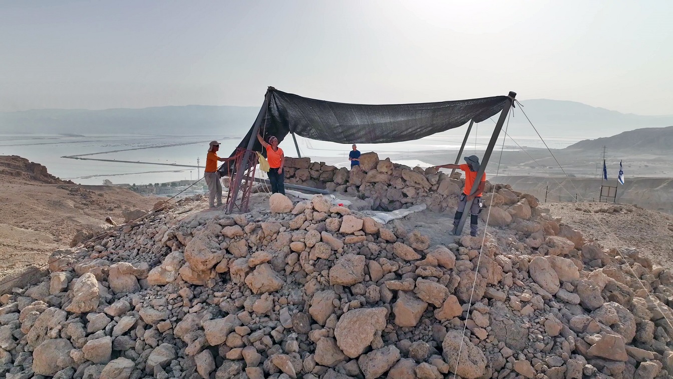
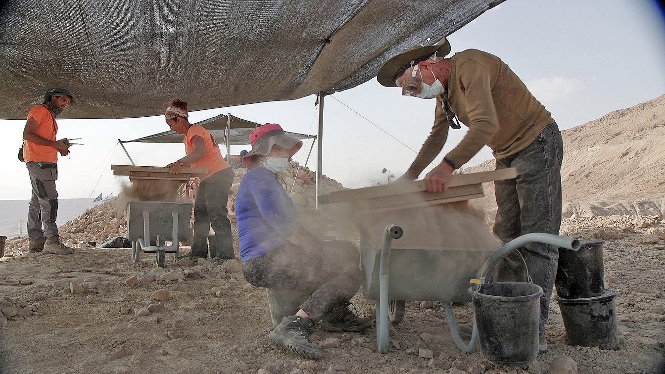
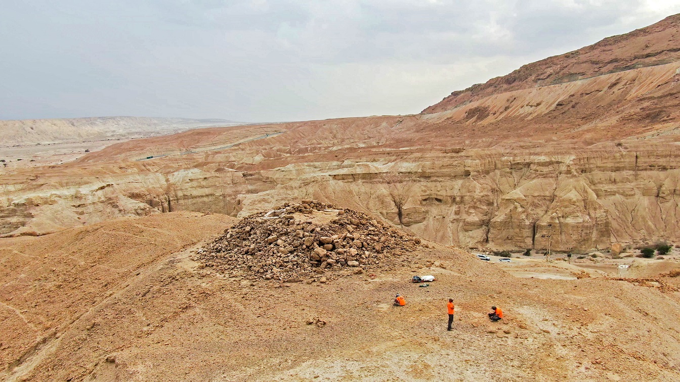
A huge 2200-year-old pyramidal structure with a way station beneath it – from the days of the Ptolemaic and Seleucid rulers— is now being unearthed in theJudean Desert, north of Nahal Zohar, by a joint Israel Antiquities Authority/Ministry of Heritage excavation, with volunteers from all over the country. Site findings so far include papyrus documents written in Greek, bronze coins of the Ptolemies and of Antiochus IV, weapons, wooden tools and fabrics.


According to Matan Toledano, Dr. Eitan Klein and Amir Ganor, excavation directors on behalf of the Israel Antiquities Authority, “What we have here is one of the richest and most intriguing archaeological excavations ever found in the Judean Desert. This pyramidal structure we discovered is huge, and made of hand-hewn stones, each one weighing hundreds of kilograms. Already in the first excavation week, the volunteers found written historical documents, exceptional bronze vessels and remains of ancient furniture, which thanks to the desert climate were preserved in amazing condition. This is a very promising site – every moment new findings are discovered, and we are filled with anticipation for what else the next three weeks might produce!”

Excavation by the Israel Antiquities Authority and volunteers, north of Nahal Zohar. Photography: Emil Aladjem, Israel Antiquities Authority.

The Israel Antiquities Authority invites the public to participate in the excavation.

The Nahal Zohar excavation is part of an extensive Judean Desert operation initiated about 8 years ago, led by the Israel Antiquities Authority, to save archaeological finds endangered by constant illicit excavation and thieving in this region. This national project is funded jointly by the Ministry of Heritage, the Judea and Samaria Civil Administration Archaeology Department, and the Israel Antiquities Authority. The dedicated Robbery Prevention Unit survey team systematically searched the entire Judean Desert region along 180 kilometers of cliffs, and located about 900 caves. With the help of abseiling equipment, advanced technologies, and unique documentation methods, thousands of rare items were uncovered – including scrolls deliberately hidden in these caves, papyrus fragments, wooden utensils, weapons, leather items, and coin hoards.

“This excavation changes the site’s historical record,” say Toledano, Klein and Ganor. “Contrary to previous hypotheses that attributed this structure to the First Temple period, it seems that it was built later – during the Hellenistic period – when the land of Israel was under Ptolemaic rule. We still do not know for certain what the building’s purpose was: Is this a guard tower, guarding an important commercial route through which the Dead Sea resources of salt and bitumen were transported to the coastal ports? Or at some point was this enormous structure on the mountaintop marking a grave, or serving as a monument in ancient history? It is an enthralling historical mystery – and to our delight, the public coming to volunteer in the excavation are our partners in uncovering the answers.”
According to Eli Escusido, Director of the Israel Antiquities Authority: “The Judean Desert survey is one of the most important archaeological operations ever undertaken in the State of Israel’s history. The discoveries are exciting and even emotional, and their significance for archaeological and historical research is enormous. Right now, just before Passover and with the onset of Spring, I invite the people of Israel to come and participate! In such a challenging time as we are in, a few days of staying in and experiencing discovery in the Judean Desert offer a connective and uplifting experience for everyone.”

A mysterious pyramid-shaped structure dating from when the Ptolemies and Seleucids ruled Israel

A piece of papyrus with Greek writing found by the excavation volunteers. Photography: Emil Aladjem, Israel Antiquities Authority.

The Israel Antiquities Authority has set up an organized camp to accommodate volunteers, provide food and water, and offer enrichment lectures about archaeology every evening. The excavation will continue for another three weeks.

If you wish to participate, please register with this link.

More details ae available on the Israel Antiquities Authority website

A little girl discovered a 3,800-years-old Canaanite seal on a family trip near Beit Shemesh


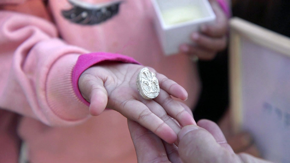
While walking with her family on a trip to Tel Azeka, near Beit Shemesh, 3.5-year-old Ziv Nitzan picked up a stone that turned out to be an ancient seal amulet from the Middle Bronze Age.


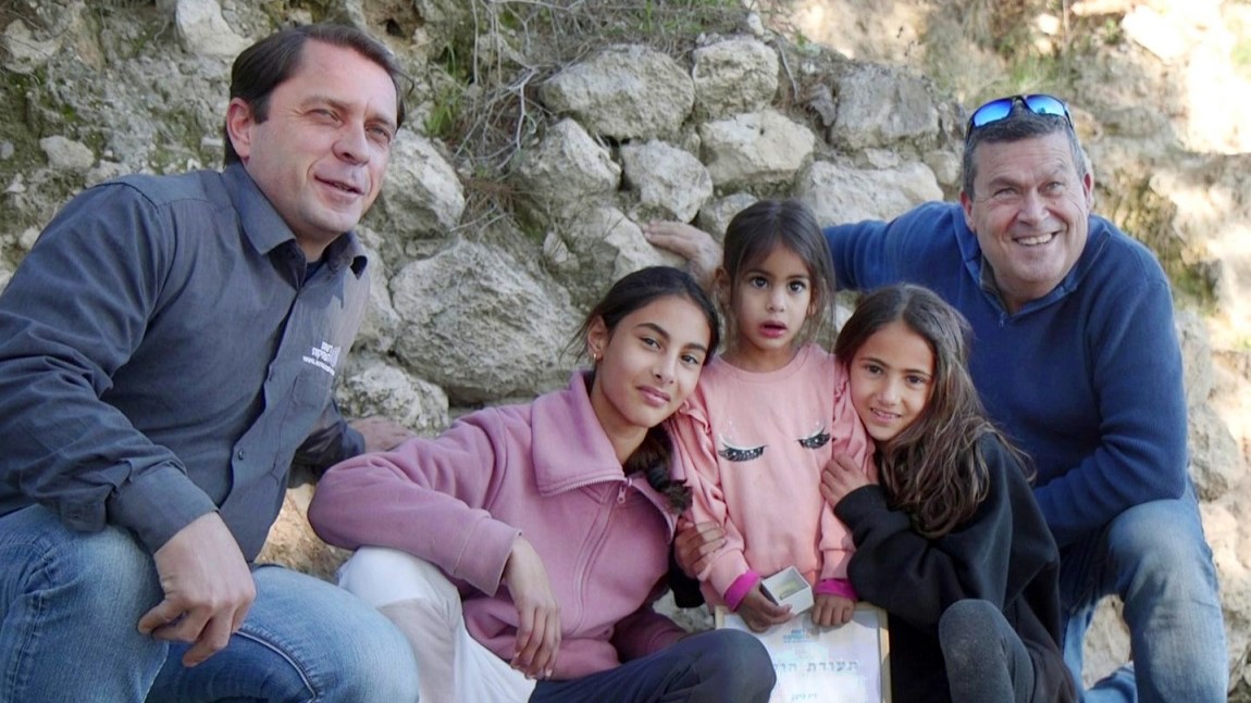
Early this past March, during a family trip to Tel Azeka, near Beit Shemesh, 3.5-year-old Ziv Nitzan from Moshav Ramot Meir found an ancient scarab amulet, about 3,800 years old. “We were walking along the path, and then Ziv bent down – and out of all the stones around her, she picked up this particular stone,” recounts Omer Nitzan, Ziv's sister. “When she rubbed it and removed the sand from it, we saw something was different about it. I called my parents to come see the beautiful stone, and we realized we had discovered an archaeological find! We immediately reported this to the Israel Antiquities Authority.”

Semyon Gendler, Judah Region District Archaeologist on behalf of the Israel Antiquities Authority, praised Ziv and her family for reporting the find, and awarded her a certificate of appreciation for good citizenship. The ancient find will be included in a special display for Passover that the Israel Antiquities Authority has prepared at the Jay and Jeanie Schottenstein National Campus for the Archaeology of Israel, alongside other finds from the days of Egypt and Canaan, most of which are being displayed for the first time.

From right to left – Prof. Oded Lipschits, Noga, Ziv and Omer Nitzan, and Semyon Gendler. Photo by Emil Aladjem, Israel Antiquities Authority

The seal in the hand of 3.5-year-old Ziv. Photo by Emil Aladjem, Israel Antiquities Authority

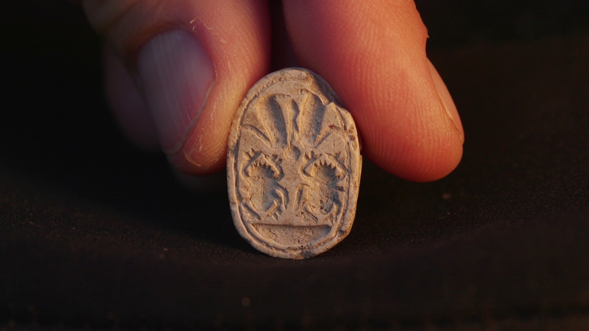
Dr. Daphna Ben-Tor, an expert in ancient amulets and seals, determined that the seal found by Ziv is a Canaanite scarab from the Middle Bronze Age – dating to about 3,800 years ago. She says, “Scarabs were used in this period as seals and as amulets. They were found in graves, in public buildings and in private homes. Sometimes they bear symbols and messages, that reflect religious beliefs or status.”

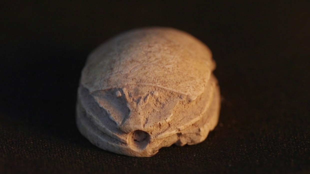
The scarab seals are tiny ornate objects, originating in ancient Egypt and designed in the shape of a dung beetle. This beetle, considered sacred in the eyes of the ancient Egyptians, was a symbol of new life, because of the dung ball it created and then laid its eggs into it, from which new life would hatch. Its name in Egyptian derives from the verb “to come into being”, or “to be created”. This is because the Egyptians saw the scarab as a symbol of the incarnation of God the Creator.

The seal from Tel Azekah. Photo by Emil Aladjem, Israel Antiquities Authority

The back of the seal from Tel Azeka – shaped like a scarab. Photo by Emil Aladjem, Israel Antiquities Authority

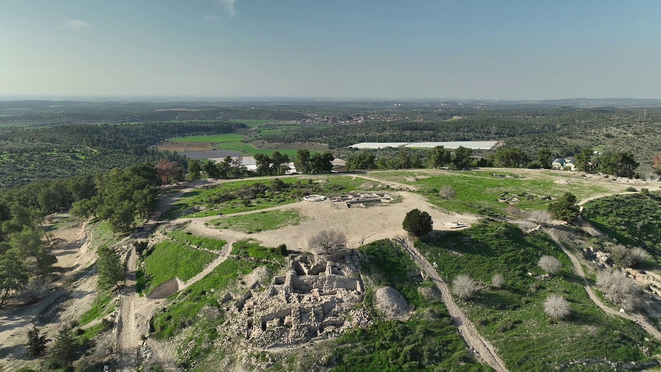
The scarab Ziv found was discovered at the foot of Tel Azeka – an important archaeological tel near Beit Shemesh. In this mound, evidence was discovered of many changing cultures over the course of history. Amongst other things, excavations by Tel Aviv University have revealed findings from the days of the Judahite Kingdom, including city walls, agricultural installations, and more. Tel Azekah was also known as a key feature in the biblical battle scene between David and Goliath as described in the Book of Samuel (Samuel I 17:1).

“We have been excavating here for almost 15 years, and the excavation findings show that during the Middle Bronze and Late Bronze Ages, here in Tel Azekah, thrived one of the most important cities in the Judean Lowlands,” says Prof. Oded Lipschits, director of the Tel Aviv University archaeological dig, who even came to meet Ziv and her sisters at the tel. “The scarab found by Ziv joins a long list of Egyptian and Canaanite finds discovered here, which attest to the close ties and cultural influences between Canaan and Egypt during that period.”

Tel Azekah – aerial view. Photo by Emil Aladjem, Israel Antiquities Authority

According to Israeli Minister of Heritage, Amichai Eliyahu, “The seal that little Ziv found during a family trip to Tel Azekah connects us to a grand story, that of the ancient civilizations that lived in this land thousands of years ago. The scarab Ziv found also reminds us that in the Land of Israel, even children can be a part of discovering history.”

“Ziv, and her family, deserve praise for handing over the find to the National Treasures of the state of Israel,” says Eli Escusido, Director of the Israel Antiquities Authority. “Thanks to her, everyone will be able to see it and enjoy it. In honor of Passover, we will present the seal in a special exhibition set up by the Israel Antiquities Authority at the Jay and Jeanie Schottenstein National Campus for the Archaeology of Israel, alongside other findings from the Egyptian and Canaanite eras. In our public tours we will present impressive items for the first time, including seals of the pharaohs, Egyptian statues, ritual vessels, and evidence of the Egyptian cultural influence in the Land of Israel – and everyone is invited!” Details are found on the Israel Antiquities Authority website

Friday, April 11, 2025

Pleistocene-age Denisovan male identified in Taiwan


A fossil Pleistocene-age hominin jawbone discovered in Taiwan has now been identified as belonging to a Denisovan, according to a new paleoproteomic analysis of the remains. The findings provide direct molecular evidence that Denisovans occupied diverse climates, from the cold Siberian mountains to the warm, humid subtropical latitudes of Taiwan, and offer new morphological insights into this enigmatic hominin lineage. 

Recent research has revealed a surprising variety of ancient human relatives that lived in eastern Asia during the Pleistocene before modern humans arrived. One of the most important discoveries is the Denisovans, a distinct group identified through DNA from fossils in Denisova Cave, Siberia. Studies show that Denisovans were closely related to Neanderthals and interbred with both them and modern humans. However, outside Siberia, direct genetic evidence of Denisovans has only been found on the Tibetan Plateau. While other fossils found across eastern Asia have been proposed as being Denisovan, their classification remains uncertain without molecular confirmation. 

Here, Takumi Tsutaya and colleagues provide paleoproteomic evidence identifying a fossil hominin mandible (Penghu 1) recovered from the Penghu Channel off Taiwan as belonging to a male Denisovan. The Penghu remains, along with various animal fossils, were retrieved through commercial fishing dredging from the seafloor, which was once part of the Asian mainland during lower sea levels in the Pleistocene. 

Using ancient proteomic analysis, Tsutaya et al. extracted proteins from bone and dental enamel from the fossil and retrieved 4,241 amino acid residues, two of which were Denisovan-specific protein variants. According to the authors, these variants are rare in modern human populations but have a higher frequency in regions associated with Denisovan genetic introgression. What’s more, morphological analysis of the Penghu 1 remains reveals a robust jaw structure with large molars, and distinctive root structures, features that align with traits seen in the Tibetan Denisovan specimen, suggesting these traits were characteristic of the lineage and perhaps sex-specific.

Thursday, April 10, 2025

Longest known seafaring venture 8,500 years ago brings hunter-gatherers to Malta before early farmers

Seafaring hunter-gatherers were accessing remote, small islands such as Malta thousands of years before the arrival of the first farmers, a new international study has found.

Published in Nature, the research team – led by Professor Eleanor Scerri of the Max Planck Institute of Geoanthropology (MPI-GEA) and the University of Malta – found hunter-gatherers were crossing at least 100km of open water to reach the Mediterranean island of Malta 8,500 years ago, a thousand years before the arrival of agricultural practises.

This report documented the oldest long-distance seafaring in the Mediterranean, before the invention of boats with sails – an astonishing feat for hunter-gatherers likely using simple dugout canoes.

At the cave site of Latnija in the northern Mellieħa region of Malta, the research team found the traces of humans in the form of their stone tools, hearths, and cooked food waste.

Small, remote islands were long thought to have been the last frontiers of pristine natural systems.

Humans were not thought to have been able to reach or inhabit these environments prior to the dawn of agriculture, and the technological shift that accompanied this transition.

“Even on the longest day of the year, these seafarers would have had over several hours of darkness in open water,” said Professor Nicholas Vella of the University of Malta, co-investigator of the study.

Dr Mathew Stewart, from Griffith University’s Australian Research Centre for Human Evolution, analysed the animal remains from this site as part of the study.

“At the site we recovered a diverse array of animals, including hundreds of remains of deer, birds, tortoises, and foxes.” Dr Stewart said.

“Some of these wild animals were long thought to have gone extinct by this point in time,” added Professor Scerri.

“They were hunting and cooking red deer alongside tortoises and birds, including some that were extremely large and extinct today.”

In addition to this, the team of researchers found clear evidence for the exploitation of marine resources.

“We found remains of seal, various fish, including grouper, and thousands of edible marine gastropods, crabs and sea urchins, all indisputably cooked,” said Dr James Blinkhorn of the University of Liverpool and MPI-GEA, one of the study’s corresponding authors.

“The incorporation of a diverse range of terrestrial and, especially, marine fauna into the diet likely enabled these hunter-gatherers to sustain themselves on an island as small as Malta,” added Dr Stewart.

These discoveries also raised questions about the extinction of endemic animals on Malta and other small and remote Mediterranean islands, and whether distant Mesolithic communities may have been linked through seafaring.

“The results add a thousand years to Maltese prehistory and force a re-evaluation of the seafaring abilities of Europe’s last hunter-gatherers, as well as their connections and ecosystem impacts,” Professor Scerri said.

The findings ‘Hunter-gatherer sea voyages extended to remotest Mediterranean islands’ have been published in Nature.


Ancient tools from a South African cave reveal connections between prehistoric people


In a cave overlooking the ocean on the southern coast of South Africa, archaeologists discovered thousands of stone tools, created by ancient humans roughly 20,000 years ago. By examining tiny details in the chipped edges of the blades and stones, archaeologists are able to tell how the tools were made. In a new study published in the Journal of Paleolithic Archaeology, researchers analyzed these stone tools and discussed how the different techniques used to make them hint at the ways that prehistoric people traveled, interacted, and shared their craft.

“This is an important insight into how people who lived in this region were living and hunting and responding to their environment,” says Sara Watson, a postdoctoral scientist at the Field Museum’s Negaunee Integrative Research Center and lead author of the study.

During the period when these blades were made, between 24,000 and 12,000 years ago, the Earth was nearing the end of the last major ice age. Since so much of the Earth’s water was frozen in glaciers and ice caps, the sea level was lower, and the region that’s now the coast of South Africa was a few miles inland. “Instead of being right on the water like they are today, these caves would have been near vast, open plains with large game animals like antelope,” says Watson. “People hunted those animals, and to do that, they developed new tools and weapons.”

The caves, part of what archaeologists call the Robberg technocomplex, no longer overlook a plain— they're in a towering cliff face over a rocky beach. “It’s a 75-foot climb up to the cave from the shoreline,” says Watson. “We had safety ropes and a staircase made of sandbags, and we had to be harnessed in while doing the excavation.”

Every day, Watson and her colleagues made the climb with all their excavation and photography equipment, weighing up to 50 pounds per person. “Since these are extremely, extremely old sites, from before the end of the last ice age, we had to be very careful with our excavation,” says Watson. “We used little tiny dental tools and mini trowels so that we could remove each little individual layer of sediment.”

Beneath ancient dust and dirt, Watson and her team found thousands of stone tools: small, sharp blades, as well as the larger pieces of rock from which these blades were chipped. The bigger rock that blades are made from is called a core. “When your average person thinks about stone tools, they probably focus on the detached pieces, the blades and flakes. But the thing that is the most interesting to me is the core, because it shows us the particular methods and order of operations that people went through in order to make their tools,” says Watson.

Watson and her colleagues observed several distinct patterns of how the cores had been broken into smaller blades. “In a lot of these technologies, the core reduction is very specific, and it’s something that you are taught and learn, and that’s where the social information is,” says Watson. “If we see specific methods of core reduction at multiple sites across the landscape, as an archaeologist, it tells me that these people were sharing ideas with one another.”

For instance, one particular method of breaking tiny bladelets off of a core that Watson found in the Robberg caves is a style also found hundreds of miles away in places including Namibia and Lesotho. “Same core reduction pattern, same intended product,” says Watson. “The pattern is repeated over and over and over again, which indicates that it is intentional and shared, rather than just a chance similarity.”

Overall, Watson says that the study reveals how much there still is to learn about the Robberg caves and the people who used them thousands of years ago. “We have a very long and rich history as a species, and humans go back a lot farther in time than most people realize,” says Watson. “People living around the last ice age were very similar to people today.”


Painted altar found at Tikal adds new context to mysterious Maya history


A newly discovered altar, buried near the center of the ancient Maya city of Tikal, is shedding new light on the 1,600-year-old tensions between Tikal and the central Mexican capital of Teotihuacan


Just steps from the center of Tikal, a 2,400-year-old Maya city in the heart of modern-day Guatemala, a global team of researchers including scholars from Brown University have unearthed a buried altar that could unlock the secrets of a mysterious time of upheaval in the ancient world.

The altar, built around the late 300s A.D., is decorated with four painted panels of red, black and yellow depicting a person wearing a feathered headdress and flanked by shields or regalia. The face has almond-shaped eyes, a nose bar and a double earspool. It closely resembles other depictions of a deity dubbed the “Storm God” in central Mexico.

In a study released on Tuesday, April 8, in Antiquity, the Brown researchers, along with co-authors from across the United States and Guatemala, argue that the painted altar wasn’t the work of a Maya artist. Instead, they believe it was created by a highly skilled artisan trained at Teotihuacan — the formidable ancient power whose seat was located 630 miles west, outside modern-day Mexico City.

“It’s increasingly clear that this was an extraordinary period of turbulence at Tikal,” said Stephen Houston, a professor of social science, anthropology, and history of art and architecture at Brown, who co-authored the paper. “What the altar confirms is that wealthy leaders from Teotihuacan came to Tikal and created replicas of ritual facilities that would have existed in their home city. It shows Teotihuacan left a heavy imprint there.”

Even before discovering the altar, Houston and colleagues knew the Maya interacted with Teotihuacan for centuries before their relationship became closer.

Founded in about 850 B.C., Tikal existed for generations as a small city with little influence before ballooning into a dynasty around 100 A.D. Archaeologists have evidence that Tikal and the much more powerful Teotihuacan began interacting regularly about two centuries later. What seemed at first to be a casual trading relationship, Houston said, quickly became something more contentious.

“It’s almost as if Tikal poked the beast and got too much attention from Teotihuacan,” Houston said. “That’s when foreigners started moving into the area.”

An ancient coup d’etat

Houston said that over several decades, scholars have collected mounting evidence of a less-than-friendly relationship. The research started in the 1960s, when archaeologists found a cut and mutilated stone with well-preserved text describing the conflict in broad terms. 

Thanks to the stone’s text, they learned that “around A.D. 378, Teotihuacan was essentially decapitating a kingdom,” Houston said. “They removed the king and replaced him with a quisling, a puppet king who proved a useful local instrument to Teotihuacan.”

Decades later, using light detection and ranging (LiDAR) technology, the Brown scholars and several colleagues discovered a scaled-down replica of the Teotihuacan citadel just outside the center of Tikal, buried under what archaeologists believed were natural hills. The discovery suggested that in the years leading up to its overthrow, Teotihuacan’s presence in the Maya city probably involved an element of occupation or surveillance.

Co-author Andrew Scherer, a professor of anthropology and of archaeology and the ancient world at Brown and director of the Joukowsky Institute for Archaeology and the Ancient World, said the altar was built right around the time of the coup. He said the altar’s meticulously painted exterior isn’t the only evidence of the capital’s heavy-handed presence: Inside the altar, the archaeologists found a child buried in a seated position, a rare practice at Tikal but common at Teotihuacan. They also found an adult interred with a dart point made of green obsidian; Scherer said the material and design of the dart point are distinct to Teotihuacan.

The fact that the altar and the area around it was later buried, Scherer said, cements the research team’s theory that Teotihuacan’s presence left Tikal forever changed and even scarred.

“The Maya regularly buried buildings and rebuilt on top of them,” Scherer said. “But here, they buried the altar and surrounding buildings and just left them, even though this would have been prime real estate centuries later. They treated it almost like a memorial or a radioactive zone. It probably speaks to the complicated feelings they had about Teotihuacan.”

Power begets power

“Complicated” is an apt way to describe Tikal’s collective memory of the Teotihuacan coup, Houston said. The event may have shaken Tikal to its core, but it ultimately made the kingdom more powerful: Over the next few centuries, Tikal rose to yet greater heights, becoming a nearly unmatched dynasty before eventually declining around 900 A.D., along with the rest of the Maya world.

“There’s a kind of nostalgia about that time, when Teotihuacan was at the height of its power and taking increasing interest in the Maya,” Houston said. “It’s something exalted for them; they looked back on it almost wistfully. Even when they were in decline, they were still thinking about local politics in context of that contact with central Mexico.”

As they uncover more details about the contentious story of Teotihuacan and Tikal, Houston and Scherer said they’re both struck by how familiar it sounds: An all-powerful empire spots paradise and decides to plunder its riches.

“Everyone knows what happened to the Aztec civilization after the Spanish arrived,” Houston said. “Our findings show evidence that that’s a tale as old as time. These powers of central Mexico reached into the Maya world because they saw it as a place of extraordinary wealth, of special feathers from tropical birds, jade and chocolate. As far as Teotihuacan was concerned, it was the land of milk and honey.”