Thursday, April 24, 2025

Ancient grape seeds show gradual domestication from Bronze Age to Medieval Period in Italy


The domestication of grapevine was a slow process in Italy, taking place over thousands of years, according to a study published April 23, 2025 in the open-access journal PLOS One by Mariano Ucchesu of the University of Montpellier, France and colleagues.

Each year, worldwide grape cultivation produces roughly 80 million tons of fresh grapes and 26 billion liters of wine, with Italian wine featuring prominently. While the deep history of viticulture is well-studied in parts of Asia and Europe, data is lacking in the western Mediterranean region. In this study, Ucchesu and colleagues analyzed more than 1,700 grape seeds from 25 archaeological sites in and around Italy spanning seven millennia from the Neolithic Period to the Medieval Period.

Morphological analysis revealed that in sites older than 1000 BC, nearly all of the grape seeds share the size and proportions of modern wild grapevine, suggesting that these fruits were gathered from the wild. Then, from roughly 1000 BC to 600 AD, the majority of grape seeds are more akin to modern domesticated varieties, although there is considerable variation in seed size and proportions, as well as the ratio of domestic to wild grapes from site to site. And in sites from the Medieval Period, starting around 700 AD, domestic grape seeds are abundant and highly similar to modern cultivated grapes.

These results indicate that grape cultivation in Italy likely began during the Late Bronze Age, followed by many centuries of gradual domestication, likely involving the mixing of wild and cultivated vines to produce new domestic varieties. The authors note that these results align with previous genetic and archaeological research, but stress the importance of future study at a wider variety of archaeological sites to fill in the picture of grape cultivation across the Mediterranean.

The authors add: “This research has made it possible, for the first time, to trace the history of the origins of viticulture in Italy. The appearance of the first domesticated grapes during the Bronze Age, in Italian archaeological contexts, points to a long-standing tradition of Italian wine heritage within the broader landscape of Western Europe.”

“This research was made possible thanks to funding received through the European Union’s Horizon 2020 research and innovation program under the Marie Curie Fellowship (2021–2023 n. Agreement-101019563-VITALY) and supported by the ANR MICA project (grant agreement ANR-22-CE27-0026). The successful outcome of the research is also due to the valuable collaboration of the archaeobotanical colleagues from CNRS-ISEM in Montpellier and all the Italian colleagues who generously provided the archaeobotanical materials, valuable advice and suggestions for this research.”

 The freely available article in PLOS One: https://plos.io/3G9l44M

Ancient Chinese swamp forest collapse linked to human activity

Chinese scientists have discovered that fragile swamp forests in the Pearl River Delta (PRD) region suddenly collapsed around 2.1 thousand years ago (ka)—with human activity as the cause.

The study, led by researchers from the Guangzhou Institute of Geochemistry and the Institute of Oceanology of the Chinese Academy of Sciences, sheds new light on the role of human activity in ecosystem collapse.

Published in Science Advances, the study focuses on Glyptostrobus pensilis (G. pensilis), a critically endangered species of Chinese swamp cypress that once thrived in extensive swamp forests in the PRD. Through palynological (i.e., pollen and spore) records, chronological data, and sedimentological evidence, the team found that the collapse of these forests approximately coincided with military conquests by the Qin and Han Empires in the region.

Pollen records from sediment cores in the PRD revealed a dramatic decline in G. pensilis—from high dominance to near-extinction—indicating a sudden anthropogenic disturbance. Burn marks on the tops of standing stumps of G. pensilis are consistent with fire attacks by the Han army during its conquest of the Nanyue Realm in 111 B.C. Additionally, increases in the presence of Poaceae—a plant family comprising cereals and other grasses—as well as pioneer plants after 2.1 ka suggest large-scale migration and the adoption of advanced agricultural practices following the conquests. The conclusion that human activity played a decisive role in the forest collapse is further supported by the presence of charcoal and anthropogenic metals like copper and lead in the region.

Principal component analysis indicates that G. pensilis is highly sensitive to human activity. The loss of G. pensilis forests marked the beginning of a decline in biodiversity due to human intervention in the PRD, contributing to the local extinction of various species, including elephants, tigers, rhinoceroses, green peafowl, crocodiles, and others.

The researchers also used pollen and organic carbon records to identify previous episodes of forest degradation in the area—at 4.2 ka and 3.5 ka—from which the ecosystem later recovered.  The 4.2 ka event is a pronounced climate extreme. The 3.5 ka event was likely a regional climate extreme, as evidenced by numerous records from low latitudes and the Southern Hemisphere. The 3.5 ka event was probably caused by volcanic activity, i.e., the Santorini eruptions (VEI=7) from 3550–3577 BP. This finding illustrates the impact of climate change and deep earth processes on vegetation.

This study explores the historical roots of environmental change, revealing the lasting impact of human activity—such as war and agriculture—on a fragile ecosystem, while identifying the temporary effects of climate and deep earth processes on the same system.


Wednesday, April 23, 2025

Treasures prove Thetford was pagan until 5th century


Jewellery in a Roman treasure hoard found in Thetford Forest, East Anglia, indicates that Thetford was pagan until the 5th century, which is longer than previously believed, a new paper published by Cambridge University Press in Journal of Roman Archaeology reveals.

The Thetford treasure was first found by a metal detectorist trespassing on a construction site at Fison’s Way on Gallows Hill, Thetford in 1979. It consisted of 81 objects, including 22 gold finger-rings, other gold jewellery, and 36 silver spoons or strainers. It is now in the collections of the British Museum and can be seen on display there.

The author of the research, Professor Ellen Swift of University of Kent, argues that there is compelling evidence that the treasure was buried in the 5th century rather than the late 4th.

Swift says: “Since wider evidence found at the site confirms the religious context previously established by inscriptions on the spoons within the hoard, this means, remarkably, that the re-dating of the Thetford hoard suggests a pagan cult centre survived there into the 5th century.

“The site’s economic assets, indicated by the value and variety of the hoard, also show that it may have wielded significant power and authority locally.”

This new chronology is supported by detailed comparisons of multiple objects (both spoons and jewellery) with context-dated finds from continental Europe, and with objects from the 5th century Hoxne hoard in the British Museum, which was found more recently than the Thetford hoard and contains many similar items.

The paper also shows that Britain was less isolated than previously believed, with the items in the treasure originating from across the Roman empire.

The Thetford jewellery especially is highly varied in style, suggesting the different pieces originated in different places. Some of the latest-dating finger-rings in the hoard likely originated in northern Italy or adjacent regions, and the necklace with conical beads from the Balkans area of Europe.

Most of the jewellery is generically ‘Mediterranean Roman’ in style illustrating a geographically widespread shared culture among elites.

Tuesday, April 22, 2025

How activity in Earth’s mantle led the ancient ancestors of elephants, giraffes, and humans into Asia and Africa


Peer-Reviewed Publication

University of Texas at Austin

Gomphotheria Followed Mantle Flow 

video: 

A plume of hot rocks that burst forth from the Earth's mantle millions of years ago helped forge a land bridge that connected Asia and Africa for the first time, allowing land animals such as the ancient ancestors of elephants to cross between the two continents.

view more 

Credit: lisha Steinberger

What roils beneath the Earth’s surface may feel a world away, but the activity can help forge land masses that dictate ocean circulation, climate patterns, and even animal activity and evolution. In fact, scientists believe that a plume of hot rocks that burst from the Earth’s mantle millions of years ago could be an important part in the story of human evolution.

In a paper published in Nature Reviews Earth & Environment, an international team of researchers investigated the formation of a large land bridge that connected Asia and Africa 20 million years ago, through what is now the Arabian Peninsula and Anatolia.

The paper brings together previously published research with new models created at The University of Texas at Austin Jackson School of Geosciences and the GFZ Helmholtz Centre for Geosciences.

This gradual uplift of land enabled the early ancestors of animals such as giraffes, elephants, rhinoceroses, cheetahs, and even humans, to roam between Africa and Asia. The appearance of the land ended a 75-million-year-long isolation of Africa from other continents.

“This study has relevance to the question of ‘How did our planet change, in general? What are the connections between life and tectonics?’” said Thorsten Becker, a study co-author and professor at the Jackson School’s Department of Earth and Planetary Sciences and Institute for Geophysics.

The story begins 50-60 million years ago, when a slab of rock sliding into the Earth’s mantle created a “conveyor belt” for hot rocks to boil up in an underground plume that reached the surface some 30 million years later. This convective activity in the mantle, coupled with the collision of tectonic plates, created an uplift in land that contributed to closing the ancient Tethys Sea, splitting it into what is now the Mediterranean and Arabian Seas, and created a landmass that bridged Asia and Africa for the first time.

The study’s lead author Eivind Straume analyzed the wide-ranging consequences of this geologic activity while he was a postdoctoral fellow at the Jackson School. He said the appearance of the land bridge and animal evolution go hand in hand.

“The shallow seaway closed several million years before it otherwise likely would have due to these specific processes — mantle convection and corresponding changes in dynamic topography,” said Straume, who is now a postdoctoral fellow at NORCE Norwegian Research Centre and The Bjerknes Centre for Climate Research. “Without the plume, you could argue that the continental collision would have been different.”

In this case, timing is everything. If it had been an additional million years before Africa and Asia were connected, the animals that made their way into and out of Africa could have been on a different evolutionary path. That includes the ancestors of today’s humans.

Several million years before the land bridge had completely closed, the primate ancestors of humans came to Africa from Asia. While those primates ended up going extinct in Asia, their lineages diversified in Africa. Then when the land bridge fully emerged, these primates re-colonized Asia.

“It’s an example of how the long-term convective evolution of the planet talks to the evolution of life,” Straume said.

This uplift of the Arabian Peninsula also had significant impacts on ocean circulation and the Earth’s climate. Nearby ocean temperatures warmed, which in turn widened seasonal temperature ranges, and made a swath of land from north Africa to central Asia more arid. Researchers believe the formation of this land bridge was a final trigger in making the Sahara a desert. And these topographical changes enhanced monsoon season in Asia, making southeast Asia wetter.

This paper brings together existing research spanning plate tectonics, mantle convection, topography and paleogeography, evolutionary anthropology, mammal evolution, climate evolution, and ocean circulation, among other topics, to tell a cohesive story of the wide-ranging effects of these mantle dynamics.

“To us at least, this is a compelling — perhaps a little bit provocative — summary of recent advancements,” Becker said.

Thursday, April 17, 2025

Tel Shiqmona during the Iron Age: An ancient Mediterranean purple dye ‘factory’

Complete report

Iron Age purple dye "factory" in Israel was in operation for almost 500 years, using mollusks in large-scale specialized manufacturing process

Purple-dyed textiles, primarily woolen, were much sought after in the Ancient Near East and the Mediterranean, and they adorned the powerful and wealthy. It is commonly assumed that in antiquity, purple dye—extracted from specific species of marine mollusks—was produced in large quantities and in many places around the Mediterranean. But despite numerous archaeological excavations, direct and unequivocal evidence for locales of purple-dye production remains very limited in scope. 

Here we present Tel Shiqmona, a small archaeological tell on Israel’s Carmel coast. It is the only site in the Near East or around the Mediterranean—indeed, in the entire world—where a sequence of purple-dye workshops has been excavated and which has clear evidence for large-scale, sustained manufacture of purple dye and dyeing in a specialized facility for half a millennium, during the Iron Age (ca. 1100–600 BCE). The number and diversity of artifacts related to purple dye manufacturing are unparalleled. 

The paper focuses on the various types of evidence related to purple dye production in their environmental and archaeological contexts. We utilize chemical, mineralogical and contextual analyses to connect several categories of finds, providing for the first time direct evidence of the instruments used in the purple-dye production process in the Iron Age Levant. The artifacts from Shiqmona also serve as a first benchmark for future identification of significant purple-dye production sites around the Mediterranean, especially in the Iron Age.

Copyright: © 2025 Shalvi et al. This is an open access article distributed under the terms of the Creative Commons Attribution License, which permits unrestricted use, distribution, and reproduction in any medium, provided the original author and source are credited. 

Sunscreen, clothes and caves may have helped Homo sapiens survive 41,000 years ago

Ancient Homo sapiens may have benefitted from sunscreen, tailored clothes and the use of caves during the shifting of the magnetic North Pole over Europe about 41,000 years ago, new University of Michigan research shows.

These technologies could have protected Homo sapiens living in Europe from harmful solar radiation. Neanderthals, on the other hand, appear to have lacked these technologies and disappeared around 40,000 years ago, according to the study, published in Science Advances and led by researchers at Michigan Engineering and the U-M Department of Anthropology.

The team found that the North Pole wandered over Europe when the magnetic field's poles started to flip positions, a natural process that has happened around 180 times over Earth's geological history. While the magnetic reversal didn't complete at the time, the magnetic field weakened to cause aurora to occur over most of the globe, and allowed more harmful UV light to come in from space. 

Around the same time, Homo sapiens appear to have started making tailored clothing and using ochre, a mineral that has sun-protective properties when applied to the skin,  with greater frequency. These behaviors could have contributed to their spread throughout Europe and Asia at a time when the Neanderthal population was declining.

"In the study, we combined all of the regions where the magnetic field would not have been connected, allowing cosmic radiation, or any kind of energetic particles from the sun, to seep all the way in to the ground," said Agnit Mukhopadhyay, lead author and U-M research affiliate in climate and space sciences and engineering. 

"We found that many of those regions actually match pretty closely with early human activity from 41,000 years ago, specifically an increase in the use of caves and an increase in the use of prehistoric sunscreen."

Wandering poles

Earth's magnetic field is created by its rotation, and by extension, the rotation of its core. The core, which is composed of molten iron, generates electrical currents, which extend in a halo around the globe. This halo helps protect Earth from cosmic radiation—the stuff that thins Earth's ozone layer and lets in more UV light. The interaction of these particles with Earth's magnetic field results in aurora as well.

Mukhopadhyay began building models of this interaction using the Space Weather Modeling Framework, a versatile numerical tool developed and maintained by the U-M Center for Space Environment Modeling, to study the sun, heliosphere and planetary space environments, including that of Earth. 

The sun continually throws hot gases and charged particles toward Earth, which, because of their extremely high temperatures, act as a plasma system. Mukhopadhyay developed a model that predicts how this plasma system interacts with Earth's magnetic field, ultimately driving the formation of the aurora.

This magnetic field has a north and south orientation: the North and South poles. The orientation of the magnetic field is why you typically only see aurora at the North and South poles, where magnetic fields are the strongest. But occasionally throughout history, these poles wander from their traditional geographic positions. These are called "geomagnetic excursions," says Mukhopadhyay. The most recent event is called the Laschamps excursion, which occurred about 41,000 years ago.

Working with Sanja Panovska, a researcher at Germany's GFZ Helmholtz Centre for Geosciences, Mukhopadhyay created a 3D reconstruction of Earth's geospace system. To do this, the researchers combined three separate models: one global model that reconstructs the geomagnetic field during the Laschamps excursion, a model of the space plasma environment around Earth, and a model that predicted what Earth's aurora looked like at the time. The resulting 3D model showed where charged particles were able to slip through Earth's geomagnetic field.

The researchers found that during the Laschamps excursion, Earth's magnetic field reduced in size to about 10% of its current strength. This allowed Earth's magnetic poles to droop down near the equator and for its magnetic field lines to expand. This would have also allowed aurora to be seen all over Europe and into northern Africa.

The researchers then laid their 3D map of Earth's space system over the world, and found that the time period of the Laschamps excursion—which lasted from about 41,000 to 39,000 BP—coincided with periods of change for groups of humans living on the planet

Cosmic rays, radiation and survival

Neanderthals and Homo sapiens coexisted in Europe, with Homo sapiens—often called anatomically modern humans—arriving roughly 56,000 years ago, says Raven Garvey, U-M associate professor of anthropology. By about 40,000 years ago, Neanderthals were no longer identified as a species in Europe.

"What some of the differences are between these species, between Neanderthals and anatomically modern humans, that might account for that disappearance has been a major anthropological question for decades," Garvey said.

Clothing may have been a contributing factor, she said. The technological means of producing clothing that fitted to the body has been discovered at archaeological sites associated with anatomically modern humans, but not necessarily Neanderthals. 

However, at sites associated with anatomically modern humans, archaeologists have found not only scrapers used in hide production, but also needles and awls—items associated with sewing. According to Garvey, tailored clothing has a twofold benefit: It was significantly warmer and the added warmth meant that people could travel farther from their hearths and shelters in search of food.

Tailored clothing could have also provided another unintended benefit—protection from sun damage, she said.

There are multiple detrimental effects of solar radiation, including ocular pathologies and folate depletion (which can lead to birth defects and increased infant mortality), "so having protection against solar radiation would also have conferred significant advantage to anyone who possessed it," Garvey said. 

Homo sapiens may have also ramped up their use of ochre, a naturally occurring pigment composed of iron oxide, clay and silica that has been used by many species of hominins for a very long time. People used it to paint objects, cave walls and even to decorate their bodies.

"There have been some experimental tests that show it has sunscreen-like properties. It's a pretty effective sunscreen, and there are also ethnographic populations that have used it primarily for that purpose," Garvey said. "Its increased production and its association primarily with anatomically modern humans (during the Laschamps) is also suggestive of people's having used it for this purpose as well."

Finding caution in the (solar) wind

The researchers are careful to underscore that their findings aren't definitive. However, they are a new way to look at already existing data.

"I think it's important to note that these findings are correlational and (ours is a) meta analysis, if you will," Garvey said. "But I think it is a fresh perspective on these data in light of the Laschamps excursion."

In addition to examining how previous excursions might have affected humans long ago, Mukhopadhyay said the 3D model offers people a way to predict how excursions might affect us in the future.

"If such an event were to happen today, we would see a complete blackout in several different sectors," he said. "Our communication satellites would not work. Many of our telecommunication arrays, which are on the ground, would be severely affected by the smallest of space weather events, not to mention the human impacts which would also play a pretty massive role in our day-to-day lives."

Mukhopadhyay also pointed out that their work also highlights that people were still able to survive on a planet whose atmosphere looked a lot different than ours does today, and this has implications for the search for life on planets other than Earth.

"Many people say that a planet cannot sustain life without a strong magnetic field," he said. "Looking at prehistoric Earth, and especially at events like this, helps us study exoplanetary physics from a very different vantage point. Life did exist back then. But it was a little bit different than it is today."

Study co-authors also include Michael Liemohn, Daniel Welling and Austin Brenner of Michigan Engineering, Natalia Ganjushkina of both Michigan Engineering and the Finnish Meteorological Institute, Ilya Usoskin of the University of Oulu and Mikhail Balikhin of the University of Sheffield.

Wednesday, April 16, 2025

A mysterious pyramid-shaped structure dating from when the Ptolemies and Seleucids ruled Israel


Documents written on papyrus, 2,200-year-old weapons and fabrics – surprising discoveries being revealed in a new Judean Desert excavation

The Israel Antiquities Authority and Ministry of Heritage invite the public to join an experience of discovery in one of the richest desert excavations ever conducted, illuminating and transforming our historical knowledge of a unique site


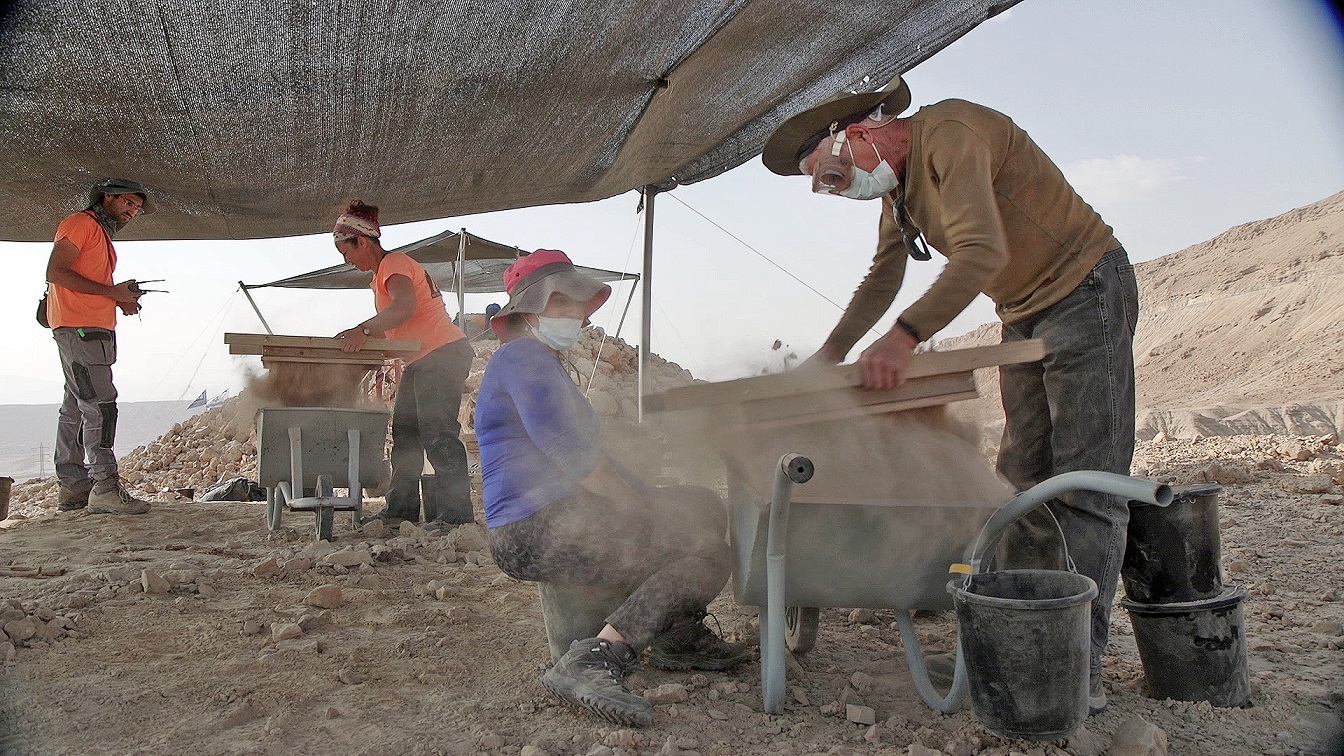
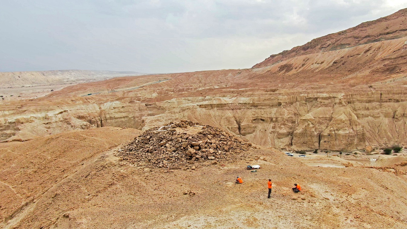
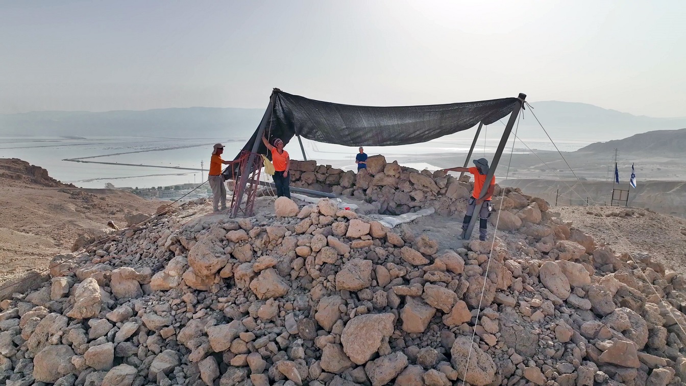
A huge 2200-year-old pyramidal structure with a way station beneath it – from the days of the Ptolemaic and Seleucid rulers— is now being unearthed in theJudean Desert, north of Nahal Zohar, by a joint Israel Antiquities Authority/Ministry of Heritage excavation, with volunteers from all over the country. Site findings so far include papyrus documents written in Greek, bronze coins of the Ptolemies and of Antiochus IV, weapons, wooden tools and fabrics.


According to Matan Toledano, Dr. Eitan Klein and Amir Ganor, excavation directors on behalf of the Israel Antiquities Authority, “What we have here is one of the richest and most intriguing archaeological excavations ever found in the Judean Desert. This pyramidal structure we discovered is huge, and made of hand-hewn stones, each one weighing hundreds of kilograms. Already in the first excavation week, the volunteers found written historical documents, exceptional bronze vessels and remains of ancient furniture, which thanks to the desert climate were preserved in amazing condition. This is a very promising site – every moment new findings are discovered, and we are filled with anticipation for what else the next three weeks might produce!”

Excavation by the Israel Antiquities Authority and volunteers, north of Nahal Zohar. Photography: Emil Aladjem, Israel Antiquities Authority.

The Israel Antiquities Authority invites the public to participate in the excavation.

The Nahal Zohar excavation is part of an extensive Judean Desert operation initiated about 8 years ago, led by the Israel Antiquities Authority, to save archaeological finds endangered by constant illicit excavation and thieving in this region. This national project is funded jointly by the Ministry of Heritage, the Judea and Samaria Civil Administration Archaeology Department, and the Israel Antiquities Authority. The dedicated Robbery Prevention Unit survey team systematically searched the entire Judean Desert region along 180 kilometers of cliffs, and located about 900 caves. With the help of abseiling equipment, advanced technologies, and unique documentation methods, thousands of rare items were uncovered – including scrolls deliberately hidden in these caves, papyrus fragments, wooden utensils, weapons, leather items, and coin hoards.

“This excavation changes the site’s historical record,” say Toledano, Klein and Ganor. “Contrary to previous hypotheses that attributed this structure to the First Temple period, it seems that it was built later – during the Hellenistic period – when the land of Israel was under Ptolemaic rule. We still do not know for certain what the building’s purpose was: Is this a guard tower, guarding an important commercial route through which the Dead Sea resources of salt and bitumen were transported to the coastal ports? Or at some point was this enormous structure on the mountaintop marking a grave, or serving as a monument in ancient history? It is an enthralling historical mystery – and to our delight, the public coming to volunteer in the excavation are our partners in uncovering the answers.”
According to Eli Escusido, Director of the Israel Antiquities Authority: “The Judean Desert survey is one of the most important archaeological operations ever undertaken in the State of Israel’s history. The discoveries are exciting and even emotional, and their significance for archaeological and historical research is enormous. Right now, just before Passover and with the onset of Spring, I invite the people of Israel to come and participate! In such a challenging time as we are in, a few days of staying in and experiencing discovery in the Judean Desert offer a connective and uplifting experience for everyone.”

A mysterious pyramid-shaped structure dating from when the Ptolemies and Seleucids ruled Israel

A piece of papyrus with Greek writing found by the excavation volunteers. Photography: Emil Aladjem, Israel Antiquities Authority.

The Israel Antiquities Authority has set up an organized camp to accommodate volunteers, provide food and water, and offer enrichment lectures about archaeology every evening. The excavation will continue for another three weeks.

If you wish to participate, please register with this link.

More details ae available on the Israel Antiquities Authority website