Thursday, December 24, 2020

Ancient DNA retells story of Caribbean's first people

 The history of the Caribbean's original islanders comes into sharper focus in a new Nature study that combines decades of archaeological work with advancements in genetic technology.

An international team led by Harvard Medical School's David Reich analyzed the genomes of 263 individuals in the largest study of ancient human DNA in the Americas to date. The genetics trace two major migratory waves in the Caribbean by two distinct groups, thousands of years apart, revealing an archipelago settled by highly mobile people, with distant relatives often living on different islands.

Reich's lab also developed a new genetic technique for estimating past population size, showing the number of people living in the Caribbean when Europeans arrived was far smaller than previously thought -- likely in the tens of thousands, rather than the million or more reported by Columbus and his successors.

For archaeologist William Keegan, whose work in the Caribbean spans more than 40 years, ancient DNA offers a powerful new tool to help resolve longstanding debates, confirm hypotheses and spotlight remaining mysteries.

This "moves our understanding of the Caribbean forward dramatically in one fell swoop," said Keegan, curator at the Florida Museum of Natural History and co-senior author of the study. "The methods David's team developed helped address questions I didn't even know we could address."

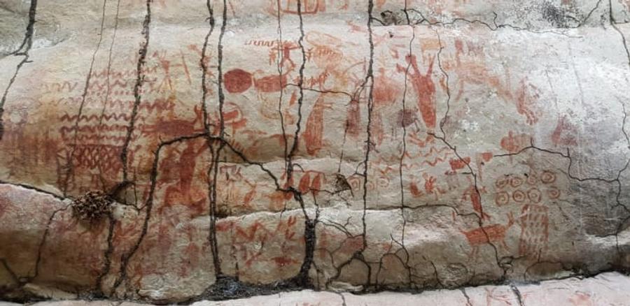
Archaeologists often rely on the remnants of domestic life -- pottery, tools, bone and shell discards -- to piece together the past. Now, technological breakthroughs in the study of ancient DNA are shedding new light on the movement of animals and humans, particularly in the Caribbean where each island can be a unique microcosm of life.

While the heat and humidity of the tropics can quickly break down organic matter, the human body contains a lockbox of genetic material: a small, unusually dense part of the bone protecting the inner ear. Primarily using this structure, researchers extracted and analyzed DNA from 174 people who lived in the Caribbean and Venezuela between 400 and 3,100 years ago, combining the data with 89 previously sequenced individuals.

The team, which includes Caribbean-based scholars, received permission to carry out the genetic analysis from local governments and cultural institutions that acted as caretakers for the human remains. The authors also engaged representatives of Caribbean Indigenous communities in a discussion of their findings.

The genetic evidence offers new insights into the peopling of the Caribbean. The islands' first inhabitants, a group of stone tool-users, boated to Cuba about 6,000 years ago, gradually expanding eastward to other islands during the region's Archaic Age. Where they came from remains unclear -- while they are more closely related to Central and South Americans than to North Americans, their genetics do not match any particular Indigenous group. However, similar artifacts found in Belize and Cuba may suggest a Central American origin, Keegan said.

About 2,500-3,000 years ago, farmers and potters related to the Arawak-speakers of northeast South America established a second pathway into the Caribbean. Using the fingers of South America's Orinoco River Basin like highways, they travelled from the interior to coastal Venezuela and pushed north into the Caribbean Sea, settling Puerto Rico and eventually moving westward. Their arrival ushered in the region's Ceramic Age, marked by agriculture and the widespread production and use of pottery.

Over time, nearly all genetic traces of Archaic Age people vanished, except for a holdout community in western Cuba that persisted as late as European arrival. Intermarriage between the two groups was rare, with only three individuals in the study showing mixed ancestry.

Many present-day Cubans, Dominicans and Puerto Ricans are the descendants of Ceramic Age people, as well as European immigrants and enslaved Africans. But researchers noted only marginal evidence of Archaic Age ancestry in modern individuals.

"That's a big mystery," Keegan said. "For Cuba, it's especially curious that we don't see more Archaic ancestry."

During the Ceramic Age, Caribbean pottery underwent at least five marked shifts in style over 2,000 years. Ornate red pottery decorated with white painted designs gave way to simple, buff-colored vessels, while other pots were punctuated with tiny dots and incisions or bore sculpted animal faces that likely doubled as handles. Some archaeologists pointed to these transitions as evidence for new migrations to the islands. But DNA tells a different story, suggesting all of the styles were developed by descendants of the people who arrived in the Caribbean 2,500-3,000 years ago, though they may have interacted with and took inspiration from outsiders.

"That was a question we might not have known to ask had we not had an archaeological expert on our team," said co-first author Kendra Sirak, a postdoctoral fellow in the Reich Lab. "We document this remarkable genetic continuity across changes in ceramic style. We talk about 'pots vs. people,' and to our knowledge, it's just pots."

Highlighting the region's interconnectivity, a study of male X chromosomes uncovered 19 pairs of "genetic cousins" living on different islands -- people who share the same amount of DNA as biological cousins but may be separated by generations. In the most striking example, one man was buried in the Bahamas while his relative was laid to rest about 600 miles away in the Dominican Republic.

"Showing relationships across different islands is really an amazing step forward," said Keegan, who added that shifting winds and currents can make passage between islands difficult. "I was really surprised to see these cousin pairings between islands."

Uncovering such a high proportion of genetic cousins in a sample of fewer than 100 men is another indicator that the region's total population size was small, said Reich, professor of genetics in the Blavatnik Institute at HMS and professor of human evolutionary biology at Harvard.

"When you sample two modern individuals, you don't often find that they're close relatives," he said. "Here, we're finding relatives all over the place."

A technique developed by study co-author Harald Ringbauer, a postdoctoral fellow in the Reich Lab, used shared segments of DNA to estimate past population size, a method that could also be applied to future studies of ancient people. Ringbauer's technique showed about 10,000 to 50,000 people were living on two of the Caribbean's largest islands, Hispaniola and Puerto Rico, shortly before European arrival. This falls far short of the million inhabitants Columbus described to his patrons, likely to impress them, Keegan said.

Later, 16th-century historian Bartolomé de las Casas claimed the region had been home to 3 million people before being decimated by European enslavement and disease. While this, too, was an exaggeration, the number of people who died as a result of colonization remains an atrocity, Reich said.

"This was a systematic program of cultural erasure. The fact that the number was not 1 million or millions of people, but rather tens of thousands, does not make that erasure any less significant," he said.

For Keegan, collaborating with geneticists gave him the ability to prove some hypotheses he had argued for years -- while upending others.

"At this point, I don't care if I'm wrong or right," he said. "It's just exciting to have a firmer basis for reevaluating how we look at the past in the Caribbean. One of the most significant outcomes of this study is that it demonstrates just how important culture is in understanding human societies. Genes may be discrete, measurable units, but the human genome is culturally created."

Ancient DNA sheds light on the peopling of the Mariana Islands


Researchers find that present-day Mariana Islanders' ancestry is linked to the Philippines

MAX PLANCK INSTITUTE FOR EVOLUTIONARY ANTHROPOLOGY

Research News

IMAGE

IMAGE: EXCAVATION WORK AREA OUTSIDE THE RITIDIAN BEACH CAVE SITE IN NORTHERN GUAM, MARIANA ISLANDS. view more 

CREDIT: HSIAO-CHUN HUNG

To reach the Mariana Islands in the Western Pacific, humans crossed more than 2,000 kilometres of open ocean, and around 2,000 years earlier than any other sea travel over an equally long distance. They settled in the Marianas around 3,500 years ago, slightly earlier than the initial settlement of Polynesia.

"We know more about the settlement of Polynesia than we do about the settlement of the Mariana Islands", says first author Irina Pugach, a researcher at the Max Planck Institute for Evolutionary Anthropology in Leipzig, Germany. The researchers wanted to find out where people came from to get to the Marianas and how the ancestors of the present Mariana Islanders, the Chamorro, might be related to Polynesians.

To address these questions the researchers obtained ancient DNA data from two skeletons from the Ritidian Beach Cave site in northern Guam, dating to around 2,200 years ago. "We found that the ancestry of these ancient skeletons is linked to the Philippines", says Pugach. "These findings strengthen the picture that has emerged from linguistic and archaeological studies, pointing to an Island Southeast Asia origin for the first settlers of the Marianas", says co-author Mike T. Carson, an archaeologist at the Micronesian Area Research Center at the University of Guam.

"We also find a close link between the ancient Guam skeletons and early Lapita individuals from Vanuatu and Tonga in the Western Pacific region", adds Pugach. "This suggests that the Marianas and Polynesia may have been colonized from the same source population, and raises the possibility that the Marianas played a role in the eventual settlement of Polynesia."

The researchers point out that while the new results provide interesting new insights, they are based on only two skeletons that date from around 1,400 years after the first human settlement in Guam. "The peopling of Guam and the settlement of such remote archipelagos in Oceania needs further investigation", says senior author Mark Stoneking of the Max Planck Institute for Evolutionary Anthropology.

Evidence for a massive paleo-tsunami at ancient Tel Dor, Israel


IMAGE

IMAGE: GEOPROBE DRILLING RIG EXTRACTION OF A SEDIMENT CORE WITH EVIDENCE OF A TSUNAMI FROM SOUTH BAY, TEL DOR, ISRAEL view more 

CREDIT: PHOTO BY T. E. LEVY

Underwater excavation, borehole drilling, and modelling suggests a massive paleo-tsunami struck near the ancient settlement of Tel Dor between 9,910 to 9,290 years ago, according to a study published December 23, 2020 in the open-access journal PLOS ONE by Gilad Shtienberg, Richard Norris and Thomas Levy from the Scripps Center for Marine Archaeology, University of California, San Diego, USA, and colleagues from Utah State University and the University of Haifa.

Tsunamis are a relatively common event along the eastern Mediterranean coastline, with historical records and geographic data showing one tsunami occurring per century for the last six thousand years. The record for earlier tsunami events, however, is less defined. In this study, Shtienberg and colleagues describe a large early Holocene tsunami deposit (between 9,910 to 9,290 years ago) in coastal sediments at Tel Dor in northwest Israel, a maritime city-mound occupied from the Middle Bronze II period (2000-1550 BCE) through the Crusader period.


To conduct their analysis, the authors used photogrammetric remote sensing techniques to create a digital model of the Tel Dor site, combined with underwater excavation and terrestrial borehole drilling to a depth of nine meters.

Along the coast of the study area, the authors found an abrupt marine shell and sand layer with an age of constraint 9,910 to 9,290 years ago, in the middle of a large ancient wetland layer spanning from 15,000 to 7,800 years ago. The authors estimate the wave capable of depositing seashells and sand in the middle of what was at the time fresh to brackish wetland must have travelled 1.5 to 3.5 km, with a coastal wave height of 16 to 40 m. For comparison, previously documented tsunami events in the eastern Mediterranean have travelled inland only around 300 m--suggesting the tsunami at Dor was generated by a far stronger mechanism. Local tsunamis tend to arise due to earthquakes in the Dead Sea Fault system and submarine landslides; the authors note that an earthquake contemporary to the Dor paleo-tsunami (dating to around 10,000 years ago) has already been identified using cave damage in the nearby Carmel ridge, suggesting this specific earthquake could have triggered an underwater landslide causing the massive tsunami at Dor.

This paleo-tsunami would have occurred during the Early to Middle Pre-Pottery Neolithic B cultural period of the region (10,700-9,250 years ago 11,700-10,500 cal BP), and potentially wiped out evidence of previous Natufian (12,500-12,000 years ago) and Pre-Pottery Neolithic coastal villages (previous surveys and excavations show a near absence of low-lying coastal villages in this region). The re-appearance of abundant Late Neolithic archaeological sites (ca. 6,000 BCE) along the coast in the years after the Dor tsunami coincides with the resumption of wetland deposition in the Dor core samples and indicates resettlement followed the event--highlighting residents' resilience in the face of massive disruption.

According to Gilad Shtienberg, a postdoc at the Scripps Center for Marine Archaeology at UC San Diego who is studying the sediment cores, "Our project focuses on reconstructing ancient climate and environmental change over the past 12,000 years along the Israeli coast; and we never dreamed of finding evidence of a prehistoric tsunami in Israel. Scholars know that at the beginning of the Neolithic, around 10,000 years ago, the seashore was 4 kilometers from where it is today. When we cut the cores open in San Diego and started seeing a marine shell layer embedded in the dry Neolithic landscape, we knew we hit the jackpot."

Monday, December 21, 2020

People in the Levant were already eating spices, fruits and oils from Asia in the Bronze and Early Iron Ages

Exotic Asian spices such as turmeric and fruits like the banana had already reached the Mediterranean more than 3000 years ago, much earlier than previously thought. A team of researchers working alongside archaeologist Philipp Stockhammer at Ludwig-Maximilians-Universität in Munich (LMU) has shown that even in the Bronze Age, long-distance trade in food was already connecting distant societies.

A market in the city of Megiddo in the Levant 3700 years ago: The market traders are hawking not only wheat, millet or dates, which grow throughout the region, but also carafes of sesame oil and bowls of a bright yellow spice that has recently appeared among their wares. This is how Philipp Stockhammer imagines the bustle of the Bronze Age market in the eastern Mediterranean. Working with an international team to analyze food residues in tooth tartar, the LMU archaeologist has found evidence that people in the Levant were already eating turmeric, bananas and even soy in the Bronze and Early Iron Ages. "Exotic spices, fruits and oils from Asia had thus reached the Mediterranean several centuries, in some cases even millennia, earlier than had been previously thought," says Stockhammer. "This is the earliest direct evidence to date of turmeric, banana and soy outside of South and East Asia." It is also direct evidence that as early as the second millennium BCE there was already a flourishing long-distance trade in exotic fruits, spices and oils, which is believed to have connected South Asia and the Levant via Mesopotamia or Egypt. While substantial trade across these regions is amply documented later on, tracing the roots of this nascent globalization has proved to be a stubborn problem. The findings of this study confirm that long-distance trade in culinary goods has connected these distant societies since at least the Bronze Age. People obviously had a great interest in exotic foods from very early on.

For their analyses, Stockhammer's international team examined 16 individuals from the Megiddo and Tel Erani excavations, which are located in present-day Israel. The region in the southern Levant served as an important bridge between the Mediterranean, Asia and Egypt in the 2nd millennium BCE. The aim of the research was to investigate the cuisines of Bronze Age Levantine populations by analyzing traces of food remnants, including ancient proteins and plant microfossils, that have remained preserved in human dental calculus over thousands of years.

The human mouth is full of bacteria, which continually petrify and form calculus. Tiny food particles become entrapped and preserved in the growing calculus, and it is these minute remnants that can now be accessed for scientific research thanks to cutting-edge methods. For the purposes of their analysis, the researchers took samples from a variety of individuals at the Bronze Age site of Megiddo and the Early Iron Age site of Tel Erani. They analyzed which food proteins and plant residues were preserved in the calculus on their teeth. "This enables us to find traces of what a person ate," says Stockhammer. "Anyone who does not practice good dental hygiene will still be telling us archaeologists what they have been eating thousands of years from now!"

Palaeoproteomics is the name of this growing new field of research. The method could develop into a standard procedure in archaeology, or so the researchers hope. "Our high-resolution study of ancient proteins and plant residues from human dental calculus is the first of its kind to study the cuisines of the ancient Near East," says Christina Warinner, a molecular archaeologist at Harvard University and the Max Planck Institute for the Science of Human History and co-senior author of the article. "Our research demonstrates the great potential of these methods to detect foods that otherwise leave few archaeological traces. Dental calculus is such a valuable source of information about the lives of ancient peoples."

"Our approach breaks new scientific ground," explains LMU biochemist and lead author Ashley Scott. That is because assigning individual protein remnants to specific foodstuffs is no small task. Beyond the painstaking work of identification, the protein itself must also survive for thousands of years. "Interestingly, we find that allergy-associated proteins appear to be the most stable in human calculus", says Scott, a finding she believes may be due to the known thermostability of many allergens. For instance, the researchers were able to detect wheat via wheat gluten proteins, says Stockhammer. The team was then able to independently confirm the presence of wheat using a type of plant microfossil known as phytoliths. Phytoliths were also used to identify millet and date palm in the Levant during the Bronze and Iron Ages, but phytoliths are not abundant or even present in many foods, which is why the new protein findings are so groundbreaking - paleoproteomics enables the identification of foods that have left few other traces, such as sesame. Sesame proteins were identified in dental calculus from both Megiddo and Tel Erani. "This suggests that sesame had become a staple food in the Levant by the 2nd millennium BCE," says Stockhammer.

Two additional protein findings are particularly remarkable, explains Stockhammer. In one individual's dental calculus from Megiddo, turmeric and soy proteins were found, while in another individual from Tel Erani banana proteins were identified. All three foods are likely to have reached the Levant via South Asia. Bananas were originally domesticated in Southeast Asia, where they had been used since the 5th millennium BCE, and they arrived in West Africa 4000 years later, but little is known about their intervening trade or use. "Our analyses thus provide crucial information on the spread of the banana around the world. No archaeological or written evidence had previously suggested such an early spread into the Mediterranean region," says Stockhammer, although the sudden appearance of banana in West Africa just a few centuries later has hinted that such a trade might have existed. "I find it spectacular that food was exchanged over long distances at such an early point in history."

Stockhammer notes that they cannot rule out the possibility, of course, that one of the individuals spent part of their life in South Asia and consumed the corresponding food only while they were there. Even if the extent to which spices, oils and fruits were imported is not yet known, there is much to indicate that trade was indeed taking place, since there is also other evidence of exotic spices in the Eastern Mediterranean - Pharaoh Ramses II was buried with peppercorns from India in 1213 BCE. They were found in his nose.

The results of the study have been published in the journal PNAS. The work is part of Stockhammer's project "FoodTransforms--Transformations of Food in the Eastern Mediterranean Late Bronze Age," which is funded by the European Research Council. The international team that produced the study encompasses scientists from LMU Munich, Harvard University and the Max Planck Institute for the Science of Human History in Jena. The fundamental question behind his project - and thus the starting point for the current study - was to clarify whether the early globalization of trade networks in the Bronze Age also concerned food. "In fact, we can now grasp the impact of globalization during the 2nd millennium BCE on East Mediterranean cuisine," says Stockhammer. "Mediterranean cuisine was characterized by intercultural exchange from an early stage." 

Discovery of 66 new Roman Army sites shows more clues about one of the empire


Discovery of 66 new Roman Army sites shows more clues about one of the empire's most infamous conflicts

UNIVERSITY OF EXETER

Research News

IMAGE

IMAGE: ROMAN MILITARY PRESENCE IN CASTILEview more 

CREDIT: ROMANARMY.EU

The discovery of dozens of new Roman Army sites thanks to remote sensing technology has revealed more about one of the empire's most infamous conflicts.

Analysis of the 66 camps shows the Roman army had a larger presence in the region than previously thought during the 200-year battle to conquer the Iberian Peninsula.

The discovery of camps of different sizes - used for training and shelter - has allowed experts to map how soldiers attacked indigenous groups from different directions and to learn more about the footprint of the Roman military presence in the northern fringe of the River Duero basin - the León, Palencia, Burgos and Cantabria provinces.

Experts analysed aerial photography and satellite images, created three-dimensional models of the terrain from LiDAR data and used drones to create detailed maps of the sites. This included resources from the Spanish National Geographic Institute (IGN) and geoportals such as Google Earth or Bing Maps. Pinpointing locations allowed fieldwork to then take place.

These temporary occupations usually left fragile and subtle traces on the surface. The ditches or the earth and stone ramparts protecting these fortifications have been filled in and flattened. Combining different remote sensing images and fieldwork shows the perimeter shape of the temporary Roman military camps, often a rectangle like a playing card.

These new sites are located at the foothills of the Cantabrian Mountains, where the conflict between Romans and natives was focused at the end of the 1st century BC. This suggests soldiers crossed between lowlands and uplands, using ridges in the mountains to stay out of site and give themselves more protection.

The fact there were so many army camps in the region shows the immense logistical support which allowed soldiers to conquer the area. Sites were used to aid movement to remote locations and to help soldiers stay in the area over the cold winter months. Some of the camps may have housed soldiers for weeks or months, and overs overnight.

The aim of the occupation was to expand the empire and to be able to exploit natural resources such as tin and gold.

The research, published in the journal Geosciences, was carried out by Andrés Menéndez Blanco, Jesús García Sánchez from the Archaeology Institute of Mérida, José Manuel Costa-García and Víctor Vicente García from the University of Santiago de Compostela, João Fonte from the University of Exeter and David González-Álvarez from the Institute of Heritage Sciences, Spanish National Research Council.

Dr Fonte said: "We have identified so many sites because we used different types of remote sensing. Airborne laser scanning gave good results for some sites in more remote places because it showed earthworks really well. Aerial photography worked better in lowland areas for the detection of cropmarks."

"The remains are of the temporary camps that the Roman army set up when moving through hostile territory or when carrying out manoeuveres around their permanent bases. They reveal the intense Roman activity at the entrance to the Cantabrian Mountains during the last phase of the Roman conquest of Hispania."

There is an important concentration of 25 sites along the valleys of northern Palencia and Burgos, as well as southern Cantabria. In the province of León, as many as 41 sites have been documented in different valleys. These range from small forts of a few hundred square meters to large fortified enclosures of 15 hectares.

Most of these Roman military sites were located in close proximity of later important Roman towns. Sasamón, a village in Burgos that was probably where nearby the Emperor Augusto established his camp during his presence in the front.

The research will continue so experts can examine the relationships the Romans established with indigenous communities, named Vaccaei, Turmogi, Cantabri, Astures and Callaeci, according to the Greek and Latin sources.

The team is currently developing a project to catalogue and document all the Roman camps in the province of León by means of drones, in order to gain a better understanding of their structures or the evolution of their state of conservation. Work is also continuing in Burgos and in Sasamón, including a study of the Cerro de Castarreño settlement and its conquest in the 1st century BC.

Tuesday, December 15, 2020

New light on the lost land of Punt


Stable isotopes confirm long-distance seafaring during the 2nd Millennium B.C.

DARTMOUTH COLLEGE

Research News

IMAGE

IMAGE: MAP OF AFRICA AND SKULL OF SPECIMEN EA6738, A MUMMIFIED BABOON RECOVERED FROM ANCIENT THEBES (MODERN-DAY LUXOR) AND NOW ACCESSIONED IN THE BRITISH MUSEUM. ISOTOPIC ANALYSIS OF EA6738 INDICATES IMPORT... view more 

CREDIT: FIGURE BY JONATHAN CHIPMAN AND NATHANIEL J. DOMINY.

Ancient Punt was a major trading partner of Egyptians for at least 1,100 years. It was an important source of luxury goods, including incense, gold, leopard skins, and living baboons. Located somewhere in the southern Red Sea region in either Africa or Arabia, scholars have debated its geographic location for more than 150 years. A new study tracing the geographic origins of Egyptian mummified baboons finds that they were sourced from an area that includes the modern-day countries of Ethiopia, Eritrea, Dijbouti, Somalia, and Yemen, providing new insight into Punt's location. Published in eLife, the results also demonstrate the tremendous nautical range of early Egyptian seafarers. A Dartmouth-led team of researchers including primatologists, Egyptologists, geographers, and geochemists, worked together to analyze the isotope composition of baboons discovered in ancient Egyptian temples and tombs, and modern baboons from across eastern Africa and southern Arabia.

"Long-distance seafaring between Egypt and Punt, two sovereign entities, was a major milestone in human history because it drove the evolution of maritime technology. Trade in exotic luxury goods, including baboons, was the engine behind early nautical innovations," explains lead author Nathaniel J. Dominy, the Charles Hansen Professor of Anthropology at Dartmouth College.

"Many scholars view trade between Egypt and Punt as the first long maritime step in a trade network known as the spice route, which would go on to shape geopolitical fortunes for millennia. Other scholars put it more simply, describing the Egypt-Punt relationship as the beginning of economic globalization," he added. "Baboons were central to this commerce, so determining the location of Punt is important. For over 150 years, Punt has been a geographic mystery. Our analysis is the first to show how mummified baboons can be used to inform this enduring debate."

Ancient Egyptians revered baboons throughout their history, with the earliest evidence dating from 3,000 B.C. Baboons were even deified, entering the pantheon of gods as manifestations of Thoth, a god associated with the moon and wisdom. One species, Papio hamadryas (the sacred baboon), was often depicted in wall paintings and other works, as a male, in a seated position with its tail curled to the right of its body. The species was among the types of baboons that were mummified in this very position with the linens carefully wrapped around its limbs and tail. Another species, Papio anubis (the olive baboon), was also mummified but it was typically wrapped in one big cocoon in a manner reflecting far less care. Baboons have never however, existed naturally in the Egyptian landscape and were a product of foreign trade in the region.

The study focused on mummified baboons from the New Kingdom period (1550-1069 B.C.) available in the British Museum and specimens from the Ptolemaic period (305-30 B.C.) available in the Petrie Museum of Egyptian Archaeology at University College London. In addition, the authors examined tissues from 155 baboons from 77 locations across eastern Africa and southern Arabia, encompassing every hypothesized location for Punt. The team measured oxygen and strontium isotope compositions and used a method called isotopic mapping to estimate the geographic origins of specimens recovered from the New Kingdom and Ptolemaic sites in Egypt.

Strontium is a chemical element that is found in bedrock, which is specific to a geographic location. As strontium erodes, its composition is absorbed into the soil and water and enters the food web. As animals drink the water and eat the plants, their teeth, and hair and bones, obtain a geographic signature reflecting where they have lived in the past and most recently, respectively.

Baboons must drink water every day and are considered obligate drinkers. Their bodies reflect the oxygen composition of water in the landscape. The enamel of an animal's adult teeth reflect the unique strontium composition of its environment when the teeth formed in early life. In contrast, hair and bone have isotope signatures that reflect the preceding months (hair) or years (bone) of dietary behavior. Similar to strontium, oxygen compositions (specifically, isotopes) of water can also vary by geographic location but the researchers found data from the specimens in this category were inconclusive, and only reflected values specific to Egypt.

The findings demonstrate that the two mummified P. hamadryas baboons from the New Kingdom period, EA6738 and EA6736, were born outside of Egypt. They had most likely come from a location in Eritrea, Ethiopia or Somalia, which narrows down the location of Punt.

The data suggest that EA6736, a P. hamadryas baboon, must have died shortly, day or months, after arriving in Egypt, as results indicate that its enamel and hair did not have sufficient time to convert to the local oxygen signature of drinking water.

Five species of mummified P. anubis from the Ptolemaic period reflected strontium levels that are consistent with an Egyptian origin, which provides tantalizing hints of a captive breeding program for baboons at this time, probably in Memphis, an ancient capital in Lower Egypt, northwest of the Red Sea.

As the researchers explain in the study, their estimated location of Punt is still provisional but the role that baboons played in the Red Sea trade network and their geographic distribution is one that is integral to understanding the historic origins of international maritime commerce.

Climate change caused the demise of Central Asia's river civilizations, not Genghis Khan


A new study challenges the long-held view that the destruction of Central Asia's medieval river civilizations was a direct result of the Mongol invasion in the early 13th century CE.

UNIVERSITY OF LINCOLN

Research News

IMAGE

IMAGE: RESEARCHERS INVESTIGATE AN ABANDONED MEDIEVAL CANAL, OTRAR OASIS, KAZAKHSTAN. view more 

CREDIT: UNIVERSITY OF LINCOLN

A new study challenges the long-held view that the destruction of Central Asia's medieval river civilizations was a direct result of the Mongol invasion in the early 13th century CE.

The Aral Sea basin in Central Asia and the major rivers flowing through the region were once home to advanced river civilizations which used floodwater irrigation to farm.

The region's decline is often attributed to the devastating Mongol invasion of the early 13th century, but new research of long-term river dynamics and ancient irrigation networks shows the changing climate and dryer conditions may have been the real cause.

Research led by the University of Lincoln, UK, reconstructed the effects of climate change on floodwater farming in the region and found that decreasing river flow was equally, if not more, important for the abandonment of these previously flourishing city states.

Mark Macklin, author and Distinguished Professor of River Systems and Global Change, and Director of the Lincoln Centre for Water and Planetary Health at the University of Lincoln said: "Our research shows that it was climate change, not Genghis Khan, that was the ultimate cause for the demise of Central Asia's forgotten river civilizations.

"We found that Central Asia recovered quickly following Arab invasions in the 7th and 8th centuries CE because of favourable wet conditions. But prolonged drought during and following the later Mongol destruction reduced the resilience of local population and prevented the re-establishment of large-scale irrigation-based agriculture."

The research focused on the archaeological sites and irrigation canals of the Otrar oasis, a UNESCO World Heritage site that was once a Silk Road trade hub located at the meeting point of the Syr Darya and Arys rivers in present southern Kazakhstan.

The researchers investigated the region to determine when the irrigation canals were abandoned and studied the past dynamics of the Arys river, whose waters fed the canals. The abandonment of irrigation systems matches a phase of riverbed erosion between the 10th and 14th century CE, that coincided with a dry period with low river flows, rather than corresponding with the Mongol invasion.

Friday, December 11, 2020

Latest Archaeology Reports

 ASIA

Fatty residues on ancient pottery reveal meat-heavy diets of Indus Civilization

Jonathan Kantrowitz, Archaeology News Report - 1 day ago
UNIVERSITY OF CAMBRIDGE Research News SHARE PRINT E-MAIL [image: IMAGE] IMAGE: LEAD AUTHOR AKSHYETA SURYANARAYAN SAMPLING POTTERY FOR RESIDUE ANALYSIS IN THE FIELD. view more CREDIT: AKSHYETA SURYANARAYAN New lipid residue analyses have revealed a dominance of animal products, such as the meat of animals like pigs, cattle, buffalo, sheep and goat as well as dairy products, used in ancient ceramic vessels from rural and urban settlements of the Indus Civilisation in north-west India, the present-day states of Haryana and Uttar Pradesh. The study, published in *Journal of ...

Ancient migration was choice, not chance - Paleolithic people likely colonized the Ryukyu Islands intentionally
Jonathan Kantrowitz, Archaeology News Report - 1 week ago
[image: IMAGE] IMAGE: A CANDIDATE BAMBOO CRAFT FOR THE RYUKYU MIGRATION BUILT FOR A RE-ENACTMENT OF THAT CROSSING. view more CREDIT: © 2020 YOSUKE KAIFU The degree of intentionality behind ancient ocean migrations, such as that to the Ryukyu Islands between Taiwan and mainland Japan, has been widely debated. Researchers used satellite-tracked buoys to simulate ancient wayward drifters and found that the vast majority failed to make the contested crossing. They concluded that Paleolithic people 35,000-30,000 years ago must therefore have made the journey not by chance but by cho...
AMERICAS

Warm oceans helped first human migration from Asia to North America
Jonathan Kantrowitz, Archaeology News Report - 1 day ago
UNIVERSITY OF WASHINGTON Research News SHARE PRINT E-MAIL [image: IMAGE] IMAGE: THE PACIFIC OCEAN'S CURRENTS SUPPORT A DIVERSE ECOSYSTEM, SEEN HERE FROM SPACE WITH GREEN INDICATING BLOOMS OF PHOTOSYNTHESIZING PLANKTON. WARMER CURRENTS DURING THE ICE AGE MAY ALSO HAVE SUPPORTED EARLY... view more CREDIT: NASA/GODDARD SPACE FLIGHT CENTER, THE SEAWIFS PROJECT AND GEOEYE, SCIENTIFIC VISUALIZATION STUDIO New research reveals significant changes to the circulation of the North Pacific and its impact on the initial migration of humans from Asia to North America. The new inter...
Jonathan Kantrowitz, Archaeology News Report - 1 week ago
Rock art found in the Amazon rainforest. Image: Professor José Iriarte via CNN Researchers from Colombia and the U.K. have found nearly eight miles of ancient rock art depicting numerous now-extinct Ice Age beasts, from mastodons to giant sloths. The Amazon rainforest discovery in the Serranía La Lindosa (Colombia) is thought to be made around 11,800 to 12,600 years ago. Created with red ochre, the vivid images document megafauna, human figures, hunting scenes and a vast array of creatures such as deer, tapirs, alligators, bats, monkeys, turtles, serpents and porcupines. "It ..
Population size, density in rise of centralized power in Peru in antiquity
Jonathan Kantrowitz, Archaeology News Report - 1 week ago
Early populations shifted from quasi-egalitarian hunter-gatherer societies to communities governed by a centralized authority in the middle to late Holocene, but how the transition occurred still puzzles anthropologists. A University of Maine-led group of researchers contend that population size and density served as crucial drivers. Anthropology professor Paul "Jim" Roscoe led the development of Power Theory, a model emphasizing the role of demography in political centralization, and applied it to the shift in power dynamics in prehistoric northern coastal societies in Peru. To...
Early human landscape modifications discovered in Amazonia
Jonathan Kantrowitz, Archaeology News Report - 1 week ago
No evidence of extensive savannah formations during the current Holocene period UNIVERSITY OF HELSINKI Research News SHARE PRINT E-MAIL [image: IMAGE] IMAGE: AERIAL VIEW OF A RESEARCH SITE CALLED SEVERINO CALAZANS. view more CREDIT: MARTTI PÄRSSINEN In 2002 Professor Alceu Ranzi (Federal University of Acre) and Prof. Martti Parssinen (University of Helsinki) decided to form an international research team to study large geometric earthworks, called geoglyphs, at the Brazilian state of Acre in South-western Amazonia. Soon it appeared that a pre-colonial civilization unknow..

The economic and cultural aspects of raising turkeys to supply feathers in the ancient Southwest.
Jonathan Kantrowitz, Archaeology News Report - 1 week ago
The ancient inhabitants of the American Southwest used around 11,500 feathers to make a turkey feather blanket, according to a new paper in the *Journal of Archaeological Science: Reports*. The people who made such blankets were ancestors of present-day Pueblo Indians such as the Hopi, Zuni and Rio Grande Pueblos. A team led by Washington State University archaeologists analyzed an approximately 800-year-old, 99 x 108 cm (about 39 x 42.5 inches) turkey feather blanket from southeastern Utah to get a better idea of how it was made. Their work revealed thousands of downy body feath...

Jonathan Kantrowitz, Archaeology News Report - 2 weeks ago
PRINT E-MAIL [image: IMAGE] IMAGE: ICE DEPOSIT AT THE EL MALPAIS NATIONAL MONUMENT IN NEW MEXICO. view more CREDIT: UNIVERSITY OF SOUTH FLORIDA - For more than 10,000 years, the people who lived on the arid landscape of modern-day western New Mexico were renowned for their complex societies, unique architecture and early economic and political systems. But surviving in what Spanish explorers would later name El Malpais, or the "bad lands," required ingenuity now being explained for the first time by an international geosciences team led by the University of South Florida. ...
Neandertals'New evidence: Neandertals buried their dead
Jonathan Kantrowitz, Archaeology News Report - 1 day ago
CNRS Research News SHARE PRINT E-MAIL [image: IMAGE] IMAGE: EXAMINING MATERIAL FROM THE 1970S EXCAVATIONS AT THE MUSÉE D'ARCHÉOLOGIE NATIONALE, FRANCE. THOUSANDS OF BONE REMAINS WERE SORTED AND 47 NEW FOSSIL REMAINS BELONGING TO THE NEANDERTAL CHILD 'LA FERRASSIE... view more CREDIT: © ANTOINE BALZEAU - CNRS/MNHN Was burial of the dead practiced by Neandertals or is it an innovation specific to our species? There are indications in favour of the first hypothesis but some scientists remain sceptical. For the first time in Europe, however, a multi-disciplinary team led b...
The impact of Neandertal DNA on human health
Jonathan Kantrowitz, Archaeology News Report - 1 week ago
A researcher at the University of Tartu described new associations between Neandertal DNA and autoimmune diseases, prostate cancer and type 2 diabetes. Modern humans migrated out of Africa more than 60,000 years ago and met and interbred with Neandertals and other archaic human groups. As a consequence, we can find that a few percent of the genomes of people outside of Africa contain traces of archaic ancestry. Large-scale resources with genetic and medical data are needed to find out how this archaic remains affect modern human health. Most previous studies have examined Europ...
Videoscope analysis of a Neanderthal skeleton reveals detailed dental information
Jonathan Kantrowitz, Archaeology News Report - 1 week ago
PRINT E-MAIL [image: IMAGE] IMAGE: AN IMAGE OF THE SKULL, COMBINED WITH A DETAIL OF THE PALATE, WITH THE MAXILLARY TEETH VISIBLE. view more CREDIT: SOPRINTENDENZA ABAP PER LA CITTÀ METROPOLITANA DI BARI. In situ observations on the dentition and oral cavity of the Neanderthal skeleton from Altamura (Italy) Funding: This work was supported by Ministero dell'Istruzione, dell'Università e della Ricerca, PRIN 2015 grant to G.M., J.M.-C. and D.M., number 2015WPHSCJ, prin.miur.it. The Soprintendenza A.B.A.P. per la città metropolitana di Bari (formerly Soprintendenza Archeologia p...

Neanderthal thumbs better adapted to holding tools with handles
Jonathan Kantrowitz, Archaeology News Report - 1 week ago
Neanderthal thumbs were better adapted to holding tools in the same way that we hold a hammer, according to a paper published in *Scientific Reports*. The findings suggest that Neanderthals may have found precision grips -- where objects are held between the tip of the finger and thumb -- more challenging than power 'squeeze' grips, where objects are held like a hammer, between the fingers and the palm with the thumb directing force. Using 3D analysis, Ameline Bardo and colleagues mapped the joints between the bones responsible for movement of the thumb -- referred to collectively ...
AFRICA
African trade routes sketched out by mediaeval beads
Jonathan Kantrowitz, Archaeology News Report - 1 week ago
An analysis of archaeological glass beads discovered in sub-Saharan West Africa brings to light the full extent of the region's international trade routes between the 7th and 13th centuries UNIVERSITÉ DE GENÈVE Research News SHARE PRINT E-MAIL [image: IMAGE] IMAGE: THE GLASS BEADS STUDIED, UNEARTHED BY ARCHAEOLOGICAL EXCAVATIONS IN DOUROU-BORO AND SADIA, MALI, AND DJOUTOUBAYA, SENEGAL. view more CREDIT: © UNIGE/TRUFFA GIACHET/SPUHLER The origin of glass beads dates back to early ancient times. The chemical composition of the beads and their morphological and technical ch...
Ancient people relied on coastal environments to survive the Last Glacial Maximum
Jonathan Kantrowitz, Archaeology News Report - 2 weeks ago
SHARE PRINT E-MAIL [image: IMAGE] IMAGE: EXCAVATIONS AT WATERFALL BLUFF, SOUTH AFRICA view more CREDIT: ERICH FISHER Humans have a longstanding relationship with the sea that spans nearly 200,000 years. Researchers have long hypothesized that places like coastlines helped people mediate global shifts between glacial and interglacial conditions and the impact that these changes had on local environments and resources needed for their survival. Coastlines were so important to early humans that they may have even provided key routes for the dispersal of people out of Africa ...

Middle Stone Age populations repeatedly occupied West African coast
Jonathan Kantrowitz, Archaeology News Report - 2 weeks ago
Excavations at Tiémassas, Senegal, indicate roughly 40,000 years of behavioural continuity, in contrast to other African regions over this period MAX PLANCK INSTITUTE FOR THE SCIENCE OF HUMAN HISTORY Research News SHARE PRINT E-MAIL [image: IMAGE] IMAGE: A LEVALLOIS CORE RECOVERED FROM EXCAVATIONS AT TIÉMASSAS, PART OF A COMMON, PERSISTENT SUITE OF STONE TOOL TECHNOLOGIES EMPLOYED AT THE SITE BETWEEN 62-25 THOUSAND YEARS AGO view more CREDIT: K. NIANG Although coastlines have widely been proposed as potential corridors of past migration, the occupation of Africa's trop...
Jonathan Kantrowitz, Archaeology News Report - 1 week ago
A new interdisciplinary study indicates agricultural market integration centuries before Roman conquest, suggesting the mechanisms that led to the Anthropocene began much earlier than assumed MAX PLANCK INSTITUTE FOR THE SCIENCE OF HUMAN HISTORY In the field of economics, the concept of a market economy is largely considered a modern phenomenon. Influential economists such as Karl Marx and Max Weber, for example, argued that although markets existed in antiquity, economies in which structures of production and distribution responded to the laws of supply and demand developed on...

Archaeology: Transition to feudal living in 14th century impacted local ecosystems
Jonathan Kantrowitz, Archaeology News Report - 2 weeks ago
SHARE PRINT E-MAIL The transition from tribal to feudal living, which occurred throughout the 14th century in Lagow, Poland had a significant impact on the local ecosystem, according to a study published in *Scientific Reports*. The findings demonstrate how historical changes to human society and economies may have changed local environments. Mariusz Lamentowicz and colleagues analysed changes in the composition of plants and pollen in different layers of peat in Pawski Lug, a nature reserve in Western Poland near the village of Lagow. Lagow was founded in the early 13th c...
Hidden 15th-century text on medieval manuscripts
Jonathan Kantrowitz, Archaeology News Report - 2 weeks ago
Imaging system they built as freshmen reveals new information about Otto Ege Collection ROCHESTER INSTITUTE OF TECHNOLOGY Research News SHARE PRINT E-MAIL [image: IMAGE] IMAGE: BY USING ULTRAVIOLET-FLUORESCENCE IMAGING, RIT STUDENTS REVEALED THAT A 15TH-CENTURY MANUSCRIPT LEAF HELD IN RIT'S CARY GRAPHIC ARTS COLLECTION WAS ACTUALLY A PALIMPSEST, A MANUSCRIPT ON PARCHMENT WITH MULTIPLE LAYERS... view more CREDIT: RIT Rochester Institute of Technology students discovered lost text on 15th-century manuscript leaves using an imaging system they developed as freshmen. By ...

The unique hydraulics in the 2nd century AD Barbegal water mills, the world's first industrial plant
Jonathan Kantrowitz, Archaeology News Report - 3 weeks ago
The unique hydraulics in the Barbegal water mills, the world's first industrial plant An elbow-shaped water flume as a special adaptation for the Barbegal mill complex and a symbol of the ingenuity of Roman engineers The Barbegal watermills in southern France are a unique complex dating back to the 2nd century AD. The construction with 16 waterwheels is, as far as is known, the first attempt in Europe to build a machine complex on an industrial scale. The complex was created when the Roman Empire was at the height of its power. However, little is known about technological ad...
ISRAEL
King David-era fort unearthed in Golan Heights
Jonathan Kantrowitz, Archaeology News Report - 4 weeks ago
Archaeologists believe the complex was built by the Aramean Kingdom of Geshur. Complete article [image: Ofri Eitan of the Kfar Hanasi pre-military academy next to the engraved stone at the site of the ancient fortified building complex uncovered in the Golan Heights, November 2020. Credit: Tidhar Moav/Israel Antiquities Authority.] Ofri Eitan of the Kfar Hanasi pre-military academy next to the engraved stone at the site of the ancient fortified building complex uncovered in the Golan Heights, November 2020. Credit: Tidhar Moav/Israel Antiquities Authority. A fortified building com...